UN
3 Cotswold Road
£ 34,000
Description
We don't have a Description for this property.
- Bedrooms
- 3
- Bathrooms
- 0
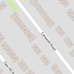

Leaflet © OpenStreetMap contributors
The heatmap indicates the level of crime in the area. The color of the heatmap indicates the crime severity and recency.
Metrics Year-on-Year
- Average area value
- 243,499.00 £Increased by 1.01 %
- Average area rental value
- 850.00 £/moIncreased by 17.73 %
- Est rental Yield
- 4.19 %Increased by 16.71 %
- Crime Rate
- 3.00 %Unchanged by 0.00 %
from 241,056.00 £
from 722.00 £/mo
from 3.59 %
from 3.00 %
Nearby Schools
| Name | Type | Ofsted | Distance |
|---|---|---|---|
| Devonshire Park Primary School | Community School | Good | 0.57 KM |
| Prenton High School For Girls | Academy Converter | Good | 0.89 KM |
| St Joseph'S Catholic Primary School, Birkenhead | Academy Sponsor Led | 0.99 KM | |
| Bedford Drive Primary School | Community School | Good | 1.07 KM |
| Woodchurch Road Primary School | Community School | Requires improvement | 1.16 KM |
Images
Nearby Streets
| Name | Average Price | Average Sqft | Distance |
|---|---|---|---|
| Pennine Road | £ 165,000 | 0 | 0.00 KM |
| Highpark Road | £ 0 | 0 | 0.00 KM |
| Borough Road | £ 425,000 | 0 | 0.00 KM |
| Stuart Road | £ 0 | 0 | 0.00 KM |
| Hawthorne Road | £ 220,000 | 0 | 0.00 KM |
Nearby Transport
| Name | NLC | TLC | Distance |
|---|---|---|---|
| Green Lane | 2218 | GNL | 2.44 KM |
| Birkenhead Central | 2217 | BKC | 2.53 KM |
| Rock Ferry | 2189 | RFY | 2.55 KM |
| Conway Park | 3624 | CNP | 2.92 KM |
| Birkenhead Park | 2220 | BKP | 3.16 KM |
Nearby Listings
| Address | Price | Type | Score | Distance |
|---|---|---|---|---|
| Cotswold Road, Prenton, Wirral | £ 175,000 | BUY | 7 / 10 | 0.02 KM |
| Cotswold Road, Prenton, Wirral, CH42 | £ 185,000 | BUY | Unknown | 0.05 KM |
| Mendip Road, Birkenhead | £ 190,000 | BUY | Unknown | 0.07 KM |
| Clee Hill Road, Birkenhead, CH42 | £ 200,000 | BUY | 6 / 10 | 0.10 KM |
| Clee Hill Road, Prenton, Wirral, CH42 | £ 185,000 | BUY | 6 / 10 | 0.10 KM |
Nearby Properties
| Address | Price | Distance |
|---|---|---|
| 29 Cotswold Road | £ 130,000 | 0.00 KM |
| 31 Cotswold Road | £ 129,000 | 0.00 KM |
| 9 Cotswold Road | £ 118,000 | 0.00 KM |
| 3 Cotswold Road | £ 34,000 | 0.00 KM |
| 1 Cotswold Road | £ 116,000 | 0.00 KM |