UN
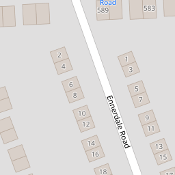
4 Ennerdale Road
£ 175,000
Description
We don't have a Description for this property.
- Bedrooms
- 3
- Bathrooms
- 0

Leaflet © OpenStreetMap contributors
The heatmap indicates the level of crime in the area. The color of the heatmap indicates the crime severity and recency.
Metrics Year-on-Year
- Average area value
- 287,500.00 £Increased by 19.71 %
- Average area rental value
- 850.00 £/moIncreased by 25.00 %
- Est rental Yield
- 3.55 %Increased by 4.41 %
- Crime Rate
- 4.00 %Unchanged by 0.00 %
from 240,163.00 £
from 680.00 £/mo
from 3.40 %
from 4.00 %
Nearby Schools
| Name | Type | Ofsted | Distance |
|---|---|---|---|
| Townfield Primary School | Academy Converter | Good | 0.87 KM |
| Prenton Children'S Centre | Children's Centre Linked Site | 1.00 KM | |
| St Michael And All Angels Catholic Primary School | Voluntary Aided School | Good | 1.20 KM |
| Prenton Primary School | Community School | Good | 1.24 KM |
| Foxfield School | Community Special School | Good | 1.40 KM |
Images
Nearby Streets
| Name | Average Price | Average Sqft | Distance |
|---|---|---|---|
| Stretton Close | £ 250,000 | 0 | 0.00 KM |
| Redwood Close | £ 0 | 0 | 0.00 KM |
| Hargrave Avenue | £ 155,000 | 0 | 0.00 KM |
| OvertonClose | £ 250,000 | 0 | 0.00 KM |
| Edgefield Close | £ 0 | 0 | 0.00 KM |
Nearby Transport
| Name | NLC | TLC | Distance |
|---|---|---|---|
| Upton (Merseyside) | 2141 | UPT | 3.00 KM |
| Birkenhead North | 2145 | BKN | 3.95 KM |
| Birkenhead Park | 2220 | BKP | 4.10 KM |
| Heswall | 2138 | HSW | 4.56 KM |
| Bidston | 2136 | BID | 4.74 KM |
Nearby Listings
| Address | Price | Type | Score | Distance |
|---|---|---|---|---|
| Woodchurch Road, Prenton, Wirral | £ 279,950 | BUY | 6 / 10 | 0.09 KM |
| Kenmore Road, Prenton | £ 250,000 | BUY | Unknown | 0.09 KM |
| Palmwood Close, Prenton | £ 250,000 | BUY | 7 / 10 | 0.23 KM |
| Woodchurch Road, Prenton, Wirral, CH43 | £ 255,000 | BUY | Unknown | 0.26 KM |
| Linden Drive, Prenton, Wirral | £ 190,000 | BUY | 7 / 10 | 0.32 KM |
Nearby Properties
| Address | Price | Distance |
|---|---|---|
| 4 Ennerdale Road | £ 175,000 | 0.00 KM |
| 6 Ennerdale Road | £ 151,950 | 0.00 KM |
| 29 Ennerdale Road | £ 178,000 | 0.00 KM |
| 1 Ennerdale Road | £ 134,000 | 0.00 KM |
| 14 Ennerdale Road | £ 215,000 | 0.00 KM |