UN
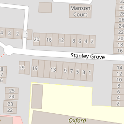
20 Stanley Grove
£ 345,000
Description
We don't have a Description for this property.
- Bedrooms
- 3
- Bathrooms
- 0


Leaflet © OpenStreetMap contributors
The heatmap indicates the level of crime in the area. The color of the heatmap indicates the crime severity and recency.
Metrics Year-on-Year
- Average area value
- 285,659.00 £Decreased by 9.05 %
- Average area rental value
- 1,215.00 £/moDecreased by 5.96 %
- Est rental Yield
- 5.10 %Increased by 3.24 %
- Crime Rate
- 15.00 %Unchanged by 0.00 %
from 314,081.00 £
from 1,292.00 £/mo
from 4.94 %
from 15.00 %
Nearby Schools
| Name | Type | Ofsted | Distance |
|---|---|---|---|
| Oxford Road Community School | Community School | Good | 0.04 KM |
| All Saints Church Of England Aided Infant School | Voluntary Aided School | Good | 0.53 KM |
| All Saints Junior School | Free Schools | Outstanding | 0.53 KM |
| Civitas Academy | Academy Sponsor Led | Good | 0.66 KM |
| St Edward'S Prep | Other Independent School | 0.91 KM |
Images
Nearby Streets
| Name | Average Price | Average Sqft | Distance |
|---|---|---|---|
| Stanley Grove | £ 0 | 0 | 0.00 KM |
| Phoenix Place | £ 165,000 | 0 | 0.00 KM |
| Bath Road | £ 0 | 0 | 0.00 KM |
| Marshall Close | £ 0 | 0 | 0.00 KM |
| Josephine Court | £ 0 | 0 | 0.00 KM |
Nearby Transport
| Name | NLC | TLC | Distance |
|---|---|---|---|
| Reading West | 3160 | RDW | 0.38 KM |
| Reading | 3149 | RDG | 1.67 KM |
| Tilehurst | 3154 | TLH | 5.07 KM |
| Earley | 5694 | EAR | 7.78 KM |
Nearby Listings
| Address | Price | Type | Score | Distance |
|---|---|---|---|---|
| George Street, Reading, Berkshire | £ 350,000 | BUY | 5 / 10 | 0.12 KM |
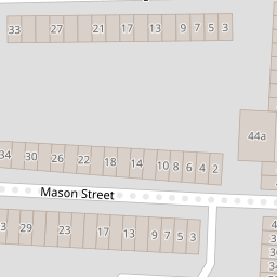
| Mason Street, Reading, Berkshire, RG1 | £ 300,000 | BUY | 6 / 10 | 0.12 KM |
| George Street, Reading, Berkshire, RG1 | £ 220,000 | BUY | 6 / 10 | 0.14 KM |
| Mason Street, Reading, RG1 | £ 325,000 | BUY | 7 / 10 | 0.16 KM |
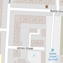
| James Street, Reading, Berkshire, RG1 | £ 475,000 | BUY | 7 / 10 | 0.16 KM |
Nearby Properties
| Address | Price | Distance |
|---|---|---|
| 5 Stanley Grove | £ 111,000 | 0.00 KM |
| 4 Stanley Grove | £ 131,000 | 0.00 KM |
| 7 Stanley Grove | £ 295,000 | 0.00 KM |
| 11 Stanley Grove | £ 108,000 | 0.00 KM |
| 20 Stanley Grove | £ 345,000 | 0.00 KM |