UN
7 Brookside
£ 325,000
Description
We don't have a Description for this property.
- Bedrooms
- 2
- Bathrooms
- 0
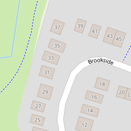


Leaflet © OpenStreetMap contributors
The heatmap indicates the level of crime in the area. The color of the heatmap indicates the crime severity and recency.
Metrics Year-on-Year
- Average area value
- 535,465.00 £Decreased by 3.72 %
- Average area rental value
- 2,008.00 £/moIncreased by 11.68 %
- Est rental Yield
- 4.50 %Increased by 15.98 %
- Crime Rate
- 2.00 %Unchanged by 0.00 %
from 556,145.00 £
from 1,798.00 £/mo
from 3.88 %
from 2.00 %
Nearby Schools
| Name | Type | Ofsted | Distance |
|---|---|---|---|
| St Paul'S Cofe Junior School | Voluntary Controlled School | Outstanding | 0.52 KM |
| Windmill Primary School | Academy Sponsor Led | Good | 0.53 KM |
| The Emmbrook School | Academy Converter | 0.54 KM | |
| Walter Infant School | Community School | Outstanding | 0.61 KM |
| Emmbrook Junior School | Community School | Requires improvement | 0.77 KM |
Images
Nearby Streets
| Name | Average Price | Average Sqft | Distance |
|---|---|---|---|
| Rotherfield Avenue | £ 675,000 | 0 | 0.00 KM |
| Chestnut Court | £ 375,000 | 0 | 0.00 KM |
| Starling Close | £ 0 | 0 | 0.00 KM |
| Snowberry Close | £ 500,000 | 0 | 0.00 KM |
| Grover Avenue | £ 0 | 0 | 0.00 KM |
Nearby Transport
| Name | NLC | TLC | Distance |
|---|---|---|---|
| Wokingham | 5696 | WKM | 1.16 KM |
| Winnersh | 5697 | WNS | 3.19 KM |
| Winnersh Triangle | 5698 | WTI | 4.94 KM |
| Crowthorne | 5628 | CRN | 6.61 KM |
| Twyford | 3155 | TWY | 6.67 KM |
Nearby Listings
| Address | Price | Type | Score | Distance |
|---|---|---|---|---|
| Brookside, Wokingham, Berkshire, RG41 | £ 500,000 | BUY | Unknown | 0.02 KM |
| Mill Close, Wokingham, Berkshire, RG41 | £ 385,000 | BUY | 7 / 10 | 0.17 KM |
| Brook Close, Wokingham | £ 470,000 | BUY | 6 / 10 | 0.28 KM |
| Reading Road, Wokingham, Berkshire, RG41 1HA | £ 785,000 | BUY | Unknown | 0.28 KM |
| Copper Beach Place, 130 Reading Road, RG41 | £ 295,000 | BUY | Unknown | 0.30 KM |
Nearby Properties
| Address | Price | Distance |
|---|---|---|
| 15 Brookside | £ 265,000 | 0.00 KM |
| 11 Brookside | £ 275,000 | 0.00 KM |
| 7 Brookside | £ 325,000 | 0.00 KM |
| 67 Brookside | £ 715,000 | 0.00 KM |
| 21 Brookside | £ 400,000 | 0.00 KM |