UN
52 Marls Road
£ 159,450
Description
We don't have a Description for this property.
- Bedrooms
- 4
- Bathrooms
- 0
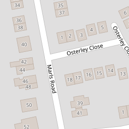


Leaflet © OpenStreetMap contributors
The heatmap indicates the level of crime in the area. The color of the heatmap indicates the crime severity and recency.
Metrics Year-on-Year
- Average area value
- 449,702.00 £Decreased by 0.87 %
- Average area rental value
- 1,431.00 £/moDecreased by 7.92 %
- Est rental Yield
- 3.82 %Decreased by 7.06 %
- Crime Rate
- 3.00 %Unchanged by 0.00 %
from 453,649.00 £
from 1,554.00 £/mo
from 4.11 %
from 3.00 %
Nearby Schools
| Name | Type | Ofsted | Distance |
|---|---|---|---|
| Freegrounds Infant School | Community School | Good | 0.77 KM |
| Freegrounds Junior School | Community School | Good | 0.77 KM |
| Berrywood Primary School | Community School | Good | 1.29 KM |
| Kings Copse Primary School | Community School | Good | 1.32 KM |
| Wildern School | Academy Converter | Outstanding | 1.46 KM |
Images
Nearby Streets
| Name | Average Price | Average Sqft | Distance |
|---|---|---|---|
| Laburnum Road | £ 300,000 | 0 | 0.00 KM |
| Patricia Drive | £ 0 | 0 | 0.00 KM |
| Hilton Road | £ 350,000 | 0 | 0.00 KM |
| Woodhouse Lane | £ 575,000 | 0 | 0.00 KM |
| Bailey Close | £ 0 | 0 | 0.00 KM |
Nearby Transport
| Name | NLC | TLC | Distance |
|---|---|---|---|
| Hedge End | 5893 | HDE | 2.10 KM |
| Botley | 5894 | BOE | 3.30 KM |
| Bursledon | 5927 | BUO | 3.83 KM |
| Swanwick | 5920 | SNW | 5.00 KM |
| Hamble | 5947 | HME | 6.51 KM |
Nearby Listings
| Address | Price | Type | Score | Distance |
|---|---|---|---|---|
| Marls Road, Botley | £ 375,000 | BUY | Unknown | 0.02 KM |
| Marls Road, Botley | £ 375,000 | BUY | Unknown | 0.16 KM |
| Marls Road, Botley, SO30 | £ 300,000 | BUY | Unknown | 0.16 KM |
| Marls Road, Botley, Southampton, Hampshire, SO30 | £ 400,000 | BUY | 6 / 10 | 0.18 KM |
| Marvin Close, Botley, SO30 | £ 425,000 | BUY | 7 / 10 | 0.19 KM |
Nearby Properties
| Address | Price | Distance |
|---|---|---|
| 40 Marls Road | £ 375,000 | 0.00 KM |
| 54 Marls Road | £ 327,000 | 0.00 KM |
| 23 Marls Road | £ 279,999 | 0.00 KM |
| 48 Marls Road | £ 238,000 | 0.00 KM |
| 52 Marls Road | £ 159,450 | 0.00 KM |