UN
16 Mill Hill
£ 575,000
Description
We don't have a Description for this property.
- Bedrooms
- 3
- Bathrooms
- 0
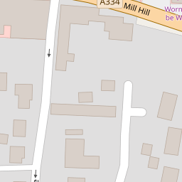


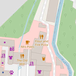


Leaflet © OpenStreetMap contributors
The heatmap indicates the level of crime in the area. The color of the heatmap indicates the crime severity and recency.
Metrics Year-on-Year
- Average area value
- 449,702.00 £Decreased by 0.87 %
- Average area rental value
- 1,431.00 £/moDecreased by 7.92 %
- Est rental Yield
- 3.82 %Decreased by 7.06 %
- Crime Rate
- 51.00 %Unchanged by 0.00 %
from 453,649.00 £
from 1,554.00 £/mo
from 4.11 %
from 51.00 %
Nearby Schools
| Name | Type | Ofsted | Distance |
|---|---|---|---|
| Botley Church Of England Controlled Primary School | Voluntary Controlled School | Outstanding | 0.10 KM |
| Hop-A-Long Children'S Centre | Children's Centre Linked Site | 0.22 KM | |
| Boorley Park | Free Schools | 1.68 KM | |
| Curdridge Primary School | Community School | Good | 2.35 KM |
| Freegrounds Infant School | Community School | Good | 2.90 KM |
Images
Nearby Streets
| Name | Average Price | Average Sqft | Distance |
|---|---|---|---|
| Alexandra Way | £ 0 | 0 | 0.00 KM |
| Starling Road | £ 616,000 | 0 | 0.00 KM |
| Nether Hill Lane | £ 1,950,000 | 0 | 0.00 KM |
| Woodhouse Lane | £ 575,000 | 0 | 0.00 KM |
| Pinehurst Cul de sac | £ 261,000 | 0 | 0.00 KM |
Nearby Transport
| Name | NLC | TLC | Distance |
|---|---|---|---|
| Botley | 5894 | BOE | 1.16 KM |
| Hedge End | 5893 | HDE | 3.42 KM |
| Swanwick | 5920 | SNW | 4.30 KM |
| Bursledon | 5927 | BUO | 5.19 KM |
| Hamble | 5947 | HME | 8.14 KM |
Nearby Listings
| Address | Price | Type | Score | Distance |
|---|---|---|---|---|
| 2 Bed Apartments at Whiteley Meadows | £ 120,000 | BUY | Unknown | 0.05 KM |
| Church Lane, Botley | £ 249,950 | BUY | Unknown | 0.22 KM |
| Four Acres, Botley | £ 450,000 | BUY | Unknown | 0.24 KM |
| Pern Drive, Botley, SO30 | £ 485,000 | BUY | Unknown | 0.27 KM |
| Winchester Street, Botley, SO30 | £ 525,000 | BUY | 6 / 10 | 0.27 KM |
Nearby Properties
| Address | Price | Distance |
|---|---|---|
| 16 Mill Hill | £ 575,000 | 0.00 KM |
| 4 Hamble Wood | £ 210,000 | 0.11 KM |
| 5 Hamblewood | £ 675,000 | 0.11 KM |
| 8 Hamble Wood | £ 500,000 | 0.12 KM |
| 12 Hamblewood | £ 585,000 | 0.12 KM |