UN
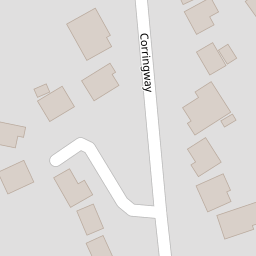
4 Corringway
£ 372,500
Description
We don't have a Description for this property.
- Bedrooms
- 4
- Bathrooms
- 0

Leaflet © OpenStreetMap contributors
The heatmap indicates the level of crime in the area. The color of the heatmap indicates the crime severity and recency.
Metrics Year-on-Year
- Average area value
- 220,958.00 £Increased by 13.54 %
- Average area rental value
- 984.00 £/moIncreased by 7.31 %
- Est rental Yield
- 5.34 %Decreased by 5.49 %
- Crime Rate
- 3.00 %Unchanged by 0.00 %
from 194,601.00 £
from 917.00 £/mo
from 5.65 %
from 3.00 %
Nearby Schools
| Name | Type | Ofsted | Distance |
|---|---|---|---|
| Velmead Junior School | Community School | Good | 0.78 KM |
| Fleet Infant School | Community School | Outstanding | 0.86 KM |
| Church Crookham Junior School | Community School | Outstanding | 1.06 KM |
| Tweseldown Infant School | Community School | Outstanding | 1.06 KM |
| Wild Rose Children'S Centre | Children's Centre Linked Site | 1.06 KM |
Images
Nearby Streets
| Name | Average Price | Average Sqft | Distance |
|---|---|---|---|
| Queens Road | £ 0 | 0 | 0.00 KM |
| The Coppice | £ 0 | 0 | 0.00 KM |
| Award Road path | £ 0 | 0 | 0.00 KM |
| Gordon Avenue | £ 550,000 | 0 | 0.00 KM |
| Hamilton Road | £ 0 | 0 | 0.00 KM |
Nearby Transport
| Name | NLC | TLC | Distance |
|---|---|---|---|
| Fleet | 5522 | FLE | 2.37 KM |
| Farnham | 5545 | FNH | 7.73 KM |
| Aldershot | 5623 | AHT | 8.35 KM |
| Winchfield | 5528 | WNF | 8.50 KM |
| Farnborough (Main) | 5521 | FNB | 8.93 KM |
Nearby Listings
| Address | Price | Type | Score | Distance |
|---|---|---|---|---|
| Corringway, Church Crookham, Fleet, GU52 | £ 625,000 | BUY | 7 / 10 | 0.05 KM |
| Hall Drive, Fleet, Hampshire, GU52 | £ 395,000 | BUY | 6 / 10 | 0.12 KM |
| Corringway, Church Crookham, Fleet, Hampshire, GU52 | £ 400,000 | BUY | 4 / 10 | 0.12 KM |
| Florence Road, Fleet, Hampshire | £ 1,250,000 | BUY | Unknown | 0.12 KM |
| Queens Road, Fleet | £ 800,000 | BUY | 7 / 10 | 0.13 KM |
Nearby Properties
| Address | Price | Distance |
|---|---|---|
| 9 Corringway | £ 390,000 | 0.00 KM |
| 10 Corringway | £ 465,000 | 0.00 KM |
| 4 Corringway | £ 372,500 | 0.00 KM |
| 5 Hall Drive | £ 366,000 | 0.13 KM |
| 21 Hall Drive | £ 450,000 | 0.13 KM |