UN
33 Pantile Drive
£ 191,500
Description
We don't have a Description for this property.
- Bedrooms
- 3
- Bathrooms
- 0
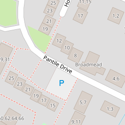


Leaflet © OpenStreetMap contributors
The heatmap indicates the level of crime in the area. The color of the heatmap indicates the crime severity and recency.
Metrics Year-on-Year
- Average area value
- 626,436.00 £Increased by 16.33 %
- Average area rental value
- 1,432.00 £/moDecreased by 4.28 %
- Est rental Yield
- 2.74 %Decreased by 17.72 %
- Crime Rate
- 19.00 %Unchanged by 0.00 %
from 538,505.00 £
from 1,496.00 £/mo
from 3.33 %
from 19.00 %
Nearby Schools
| Name | Type | Ofsted | Distance |
|---|---|---|---|
| Hook Junior School | Community School | Outstanding | 1.01 KM |
| Hook Infant School | Community School | Outstanding | 1.01 KM |
| Robert May'S School | Academy Converter | Good | 3.54 KM |
| Wisteria Children'S Centre | Children's Centre Linked Site | 3.70 KM | |
| Mayhill Junior School | Community School | Good | 3.74 KM |
Images
Nearby Streets
| Name | Average Price | Average Sqft | Distance |
|---|---|---|---|
| Whitewater Rise | £ 575,000 | 0 | 0.00 KM |
| Redes Close | £ 835,000 | 0 | 0.00 KM |
| St Johns Close | £ 0 | 0 | 0.00 KM |
| M3 | £ 600,398 | 0 | 0.00 KM |
| Durley Place | £ 0 | 0 | 0.00 KM |
Nearby Transport
| Name | NLC | TLC | Distance |
|---|---|---|---|
| Hook | 5523 | HOK | 1.44 KM |
| Winchfield | 5528 | WNF | 4.70 KM |
Nearby Listings
| Address | Price | Type | Score | Distance |
|---|---|---|---|---|
| Holt Way, Hook, RG27 | £ 385,000 | BUY | 6 / 10 | 0.05 KM |
| Holt Way, Hook, Hampshire | £ 610,000 | BUY | Unknown | 0.07 KM |
| Farm Ground Close, Hook, Hampshire, RG27 | £ 595,000 | BUY | 6 / 10 | 0.12 KM |
| Bow Field, Hook, Hampshire, RG27 | £ 325,000 | BUY | Unknown | 0.13 KM |
| Holt Lane, Hook, RG27 | £ 675,000 | BUY | 6 / 10 | 0.17 KM |
Nearby Properties
| Address | Price | Distance |
|---|---|---|
| 5 Pantile Drive | £ 320,000 | 0.00 KM |
| 1b Pantile Drive | £ 265,000 | 0.00 KM |
| 1a Pantile Drive | £ 299,950 | 0.00 KM |
| 17 Pantile Drive | £ 258,000 | 0.00 KM |
| 33 Pantile Drive | £ 191,500 | 0.00 KM |