UN
3 De Montfort Square
£ 759,950
Description
We don't have a Description for this property.
- Bedrooms
- 4
- Bathrooms
- 0
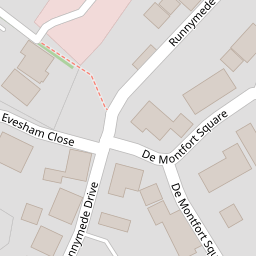

Leaflet © OpenStreetMap contributors
The heatmap indicates the level of crime in the area. The color of the heatmap indicates the crime severity and recency.
Metrics Year-on-Year
- Average area value
- 220,958.00 £Increased by 13.54 %
- Average area rental value
- 984.00 £/moIncreased by 7.31 %
- Est rental Yield
- 5.34 %Decreased by 5.49 %
- Crime Rate
- 75.00 %Unchanged by 0.00 %
from 194,601.00 £
from 917.00 £/mo
from 5.65 %
from 75.00 %
Nearby Schools
| Name | Type | Ofsted | Distance |
|---|---|---|---|
| Mayhill Junior School | Community School | Good | 1.23 KM |
| Buryfields Infant School | Community School | Good | 1.25 KM |
| Wisteria Children'S Centre | Children's Centre Linked Site | 1.25 KM | |
| Robert May'S School | Academy Converter | Good | 2.57 KM |
| Hook Junior School | Community School | Outstanding | 4.25 KM |
Images
Nearby Streets
| Name | Average Price | Average Sqft | Distance |
|---|---|---|---|
| Eleanor Walk | £ 0 | 0 | 0.00 KM |
| Hatchwood House | £ 0 | 0 | 0.00 KM |
| Seymour Place | £ 0 | 0 | 0.00 KM |
| Ralph Court | £ 0 | 0 | 0.00 KM |
| South Ridge | £ 395,000 | 0 | 0.00 KM |
Nearby Transport
| Name | NLC | TLC | Distance |
|---|---|---|---|
| Winchfield | 5528 | WNF | 3.94 KM |
| Hook | 5523 | HOK | 4.29 KM |
Nearby Listings
| Address | Price | Type | Score | Distance |
|---|---|---|---|---|
| Eleanor Walk, Odiham, Hook, Hampshire, RG29 | £ 525,000 | BUY | Unknown | 0.09 KM |
| Runnymede Drive, Odiham, Hook, RG29 | £ 475,000 | BUY | 6 / 10 | 0.17 KM |
| Waverley Close, Odiham, RG29 | £ 745,000 | BUY | 7 / 10 | 0.24 KM |
| Waverley Close, Odiham | £ 795,000 | BUY | 7 / 10 | 0.26 KM |
| Colt Hill, Odiham, Hook, RG29 | £ 800,000 | BUY | 6 / 10 | 0.37 KM |
Nearby Properties
| Address | Price | Distance |
|---|---|---|
| 3 De Montfort Square | £ 759,950 | 0.00 KM |
| Exmoor Gate | £ 275,000 | 0.22 KM |
| Wyndham | £ 376,000 | 0.22 KM |
| Seldown | £ 610,000 | 0.26 KM |
| 4 The Mapletons | £ 825,000 | 0.31 KM |