UN
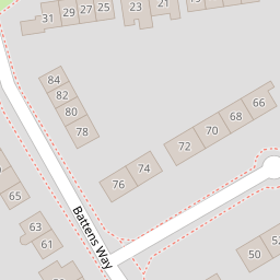
82 Battens Way
£ 195,000
Description
We don't have a Description for this property.
- Bedrooms
- 3
- Bathrooms
- 0

Leaflet © OpenStreetMap contributors
The heatmap indicates the level of crime in the area. The color of the heatmap indicates the crime severity and recency.
Metrics Year-on-Year
- Average area value
- 436,333.00 £Decreased by 35.99 %
- Average area rental value
- 1,469.00 £/moIncreased by 1.10 %
- Est rental Yield
- 4.04 %Increased by 57.81 %
- Crime Rate
- 11.00 %Unchanged by 0.00 %
from 681,667.00 £
from 1,453.00 £/mo
from 2.56 %
from 11.00 %
Nearby Schools
| Name | Type | Ofsted | Distance |
|---|---|---|---|
| Trospacc Children'S Centre | Children's Centre | 0.65 KM | |
| Trosnant Junior School | Community School | Good | 0.65 KM |
| Trosnant Infant School | Community School | Good | 0.65 KM |
| Front Lawn Primary Academy | Academy Sponsor Led | Good | 0.67 KM |
| St Alban'S Church Of England Aided Primary School | Voluntary Aided School | Good | 1.04 KM |
Images
Nearby Streets
| Name | Average Price | Average Sqft | Distance |
|---|---|---|---|
| Petersfield Road | £ 0 | 0 | 0.00 KM |
| New Road Roundabout | £ 330,000 | 0 | 0.00 KM |
| Juventu Close | £ 380,000 | 0 | 0.00 KM |
| Martin Road | £ 0 | 0 | 0.00 KM |
| Cotswold Close | £ 335,000 | 0 | 0.00 KM |
Nearby Transport
| Name | NLC | TLC | Distance |
|---|---|---|---|
| Havant | 5532 | HAV | 1.16 KM |
| Bedhampton | 5538 | BDH | 1.92 KM |
| Warblington | 5264 | WBL | 2.11 KM |
| Rowlands Castle | 5658 | RLN | 4.11 KM |
| Emsworth | 5257 | EMS | 5.08 KM |
Nearby Listings
| Address | Price | Type | Score | Distance |
|---|---|---|---|---|
| Battens Way, Havant | £ 325,000 | BUY | 7 / 10 | 0.08 KM |
| Stockheath Road, Leigh Park | £ 285,000 | BUY | Unknown | 0.17 KM |
| Battens Way, Havant, Hampshire, PO9 | £ 315,000 | BUY | Unknown | 0.21 KM |
| Battens Way, Havant | £ 355,000 | BUY | 7 / 10 | 0.23 KM |
| Woodlands Way, Havant, Hampshire | £ 215,000 | BUY | Unknown | 0.26 KM |
Nearby Properties
| Address | Price | Distance |
|---|---|---|
| 82 Battens Way | £ 195,000 | 0.00 KM |
| 61 Battens Way | £ 220,000 | 0.00 KM |
| 49 Battens Way | £ 82,995 | 0.00 KM |
| 42 Battens Way | £ 158,000 | 0.00 KM |
| 40 Battens Way | £ 132,000 | 0.00 KM |