UN
5 Lasham Green
£ 131,500
Description
We don't have a Description for this property.
- Bedrooms
- 2
- Bathrooms
- 0
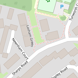


Leaflet © OpenStreetMap contributors
The heatmap indicates the level of crime in the area. The color of the heatmap indicates the crime severity and recency.
Metrics Year-on-Year
- Average area value
- 543,000.00 £Increased by 8.02 %
- Average area rental value
- 1,400.00 £/moDecreased by 23.75 %
- Est rental Yield
- 3.09 %Decreased by 29.45 %
- Crime Rate
- 19.00 %Unchanged by 0.00 %
from 502,673.00 £
from 1,836.00 £/mo
from 4.38 %
from 19.00 %
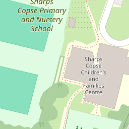
Nearby Schools
| Name | Type | Ofsted | Distance |
|---|---|---|---|
| Sharps Copse Primary And Nursery School | Community School | Good | 0.12 KM |
| Sharps Copse And Park Futures Children'S Centre | Children's Centre | 0.15 KM | |
| Havant Academy | Academy Sponsor Led | Good | 0.84 KM |
| St Alban'S Church Of England Aided Primary School | Voluntary Aided School | Good | 0.87 KM |
| Front Lawn Primary Academy | Academy Sponsor Led | Good | 1.10 KM |
Images
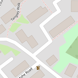
Nearby Streets
| Name | Average Price | Average Sqft | Distance |
|---|---|---|---|
| Chawton Way | £ 0 | 0 | 0.00 KM |
| Ashe Road | £ 0 | 0 | 0.00 KM |
| Rotherwick Close | £ 0 | 0 | 0.00 KM |
| Oakfield Court | £ 278,750 | 0 | 0.00 KM |
| Martin Road | £ 0 | 0 | 0.00 KM |
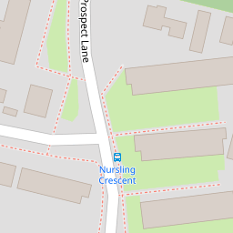
Nearby Transport
| Name | NLC | TLC | Distance |
|---|---|---|---|
| Warblington | 5264 | WBL | 1.74 KM |
| Havant | 5532 | HAV | 2.12 KM |
| Rowlands Castle | 5658 | RLN | 2.90 KM |
| Bedhampton | 5538 | BDH | 3.38 KM |
| Emsworth | 5257 | EMS | 3.91 KM |
Nearby Listings
| Address | Price | Type | Score | Distance |
|---|---|---|---|---|
| Prospect Lane, Havant | £ 160,000 | BUY | 7 / 10 | 0.07 KM |
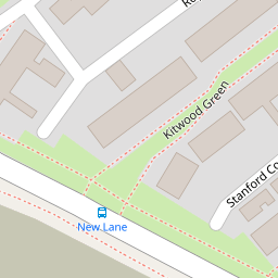
| Kitwood Green, Havant, Hampshire, PO9 | £ 240,000 | BUY | 7 / 10 | 0.13 KM |
| Prospect Lane, Havant | £ 335,000 | BUY | 6 / 10 | 0.14 KM |
| Sharps Road, Havant, Hampshire, PO9 | £ 260,000 | BUY | 6 / 10 | 0.14 KM |
| Baybridge Road, Havant, Hampshire, PO9 | £ 300,000 | BUY | 7 / 10 | 0.26 KM |
Nearby Properties
| Address | Price | Distance |
|---|---|---|
| 5 Lasham Green | £ 131,500 | 0.00 KM |
| 11 Lasham Green | £ 179,000 | 0.00 KM |
| 16 Sharps Road | £ 103,000 | 0.06 KM |
| 4 Sharps Road | £ 200,000 | 0.06 KM |
| 19 Sharps Road | £ 152,500 | 0.06 KM |