UN
9 Coltsfoot Drive
£ 181,000
Description
We don't have a Description for this property.
- Bedrooms
- 3
- Bathrooms
- 0
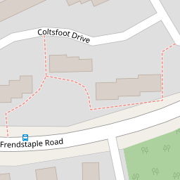

Leaflet © OpenStreetMap contributors
The heatmap indicates the level of crime in the area. The color of the heatmap indicates the crime severity and recency.
Metrics Year-on-Year
- Average area value
- 436,333.00 £Decreased by 35.99 %
- Average area rental value
- 1,469.00 £/moIncreased by 1.10 %
- Est rental Yield
- 4.04 %Increased by 57.81 %
- Crime Rate
- 6.00 %Unchanged by 0.00 %
from 681,667.00 £
from 1,453.00 £/mo
from 2.56 %
from 6.00 %
Nearby Schools
| Name | Type | Ofsted | Distance |
|---|---|---|---|
| St Peter'S Catholic Primary School, Waterlooville | Voluntary Aided School | Good | 0.27 KM |
| Oaklands Catholic School | Academy Converter | Good | 0.28 KM |
| Springwood Junior School | Community School | Good | 0.46 KM |
| Springwood Infant School | Community School | Good | 0.46 KM |
| Crookhorn College | Foundation School | Good | 0.68 KM |
Images
Nearby Streets
| Name | Average Price | Average Sqft | Distance |
|---|---|---|---|
| Bluebell Close | £ 0 | 0 | 0.00 KM |
| Sorrel Close | £ 290,000 | 0 | 0.00 KM |
| Stirling Avenue | £ 465,000 | 0 | 0.00 KM |
| Robinia Close | £ 410,000 | 0 | 0.00 KM |
| Monarch Close | £ 400,000 | 0 | 0.00 KM |
Nearby Transport
| Name | NLC | TLC | Distance |
|---|---|---|---|
| Bedhampton | 5538 | BDH | 3.41 KM |
| Havant | 5532 | HAV | 4.78 KM |
| Cosham | 5896 | CSA | 6.01 KM |
| Hilsea | 5539 | HLS | 6.29 KM |
| Warblington | 5264 | WBL | 6.31 KM |
Nearby Listings
| Address | Price | Type | Score | Distance |
|---|---|---|---|---|
| Honey Suckle Court, Waterlooville, Hampshire, PO7 | £ 290,000 | BUY | 6 / 10 | 0.06 KM |
| Dogwood Dell, Waterlooville | £ 270,000 | BUY | 7 / 10 | 0.14 KM |
| Dogwood Dell, Waterlooville | £ 270,000 | BUY | Unknown | 0.14 KM |
| Sweetbriar Gardens, Waterlooville, Hampshire, PO7 | £ 230,000 | BUY | 6 / 10 | 0.22 KM |
| Laurus Close, Waterlooville | £ 255,000 | BUY | 5 / 10 | 0.32 KM |
Nearby Properties
| Address | Price | Distance |
|---|---|---|
| 10 Coltsfoot Drive | £ 130,000 | 0.00 KM |
| 16 Coltsfoot Drive | £ 49,000 | 0.00 KM |
| 11 Coltsfoot Drive | £ 62,000 | 0.00 KM |
| 6 Coltsfoot Drive | £ 237,000 | 0.00 KM |
| 9 Coltsfoot Drive | £ 181,000 | 0.00 KM |