UN
75 The Dell
£ 357,950
Description
We don't have a Description for this property.
- Bedrooms
- 4
- Bathrooms
- 0
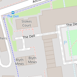


Leaflet © OpenStreetMap contributors
The heatmap indicates the level of crime in the area. The color of the heatmap indicates the crime severity and recency.
Metrics Year-on-Year
- Average area value
- 296,423.00 £Increased by 19.63 %
- Average area rental value
- 1,346.00 £/moDecreased by 0.88 %
- Est rental Yield
- 5.45 %Decreased by 17.17 %
- Crime Rate
- 4.00 %Unchanged by 0.00 %
from 247,785.00 £
from 1,358.00 £/mo
from 6.58 %
from 4.00 %
Nearby Schools
| Name | Type | Ofsted | Distance |
|---|---|---|---|
| Springhill Catholic Primary School | Academy Converter | 0.16 KM | |
| The Polygon School | Foundation Special School | Good | 0.47 KM |
| Banister Primary School | Foundation School | Good | 0.53 KM |
| St Anne'S Catholic School | Academy Converter | Outstanding | 0.88 KM |
| King Edward Vi School | Other Independent School | 1.00 KM |
Images
Nearby Streets
| Name | Average Price | Average Sqft | Distance |
|---|---|---|---|
| Morris Road | £ 0 | 0 | 0.00 KM |
| Commercial Road | £ 0 | 0 | 0.00 KM |
| Grosvenor Square | £ 0 | 0 | 0.00 KM |
| Western District Cut | £ 0 | 0 | 0.00 KM |
| Saxon Road | £ 0 | 0 | 0.00 KM |
Nearby Transport
| Name | NLC | TLC | Distance |
|---|---|---|---|
| Southampton Central | 5932 | SOU | 0.79 KM |
| Millbrook (Hants) | 5909 | MBK | 2.25 KM |
| St Denys | 5914 | SDN | 3.00 KM |
| Bitterne | 5945 | BTE | 4.08 KM |
| Woolston | 5925 | WLS | 4.41 KM |
Nearby Listings
| Address | Price | Type | Score | Distance |
|---|---|---|---|---|
| The Dell, Southampton, Hampshire, SO15 | £ 465,000 | BUY | 7 / 10 | 0.00 KM |
| The Dell, Southampton, Hampshire, SO15 | £ 450,000 | BUY | 7 / 10 | 0.00 KM |
| The Dell, Southampton, Hampshire, SO15 | £ 200,000 | BUY | Unknown | 0.04 KM |
| The Dell, Southampton, Hampshire, SO15 | £ 200,000 | BUY | Unknown | 0.04 KM |
| The Dell, Southampton, Hampshire, SO15 | £ 230,000 | BUY | 5 / 10 | 0.04 KM |
Nearby Properties
| Address | Price | Distance |
|---|---|---|
| 71 The Dell | £ 310,000 | 0.00 KM |
| 70 The Dell | £ 349,950 | 0.00 KM |
| 76 The Dell | £ 382,000 | 0.00 KM |
| 74 The Dell | £ 350,000 | 0.00 KM |
| 75 The Dell | £ 357,950 | 0.00 KM |