UN
5 Ashdene
£ 185,000
Description
We don't have a Description for this property.
- Bedrooms
- 3
- Bathrooms
- 0
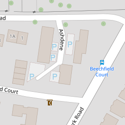

Leaflet © OpenStreetMap contributors
The heatmap indicates the level of crime in the area. The color of the heatmap indicates the crime severity and recency.
Metrics Year-on-Year
- Average area value
- 272,805.00 £Decreased by 1.37 %
- Average area rental value
- 1,184.00 £/moDecreased by 4.82 %
- Est rental Yield
- 5.21 %Decreased by 3.52 %
- Crime Rate
- 1.00 %Unchanged by 0.00 %
from 276,596.00 £
from 1,244.00 £/mo
from 5.40 %
from 1.00 %
Nearby Schools
| Name | Type | Ofsted | Distance |
|---|---|---|---|
| Regents Park Community College | Foundation School | Good | 0.45 KM |
| Foundry Lane Primary School | Foundation School | Good | 0.53 KM |
| Wordsworth Primary School | Academy Converter | Good | 0.84 KM |
| Shirley Warren Primary & Nursery School | Community School | Good | 1.02 KM |
| Lordshill, Shirley Warren And Coxford Children'S Centre. | Children's Centre | 1.11 KM |
Images
Nearby Streets
| Name | Average Price | Average Sqft | Distance |
|---|---|---|---|
| Cindy Court | £ 154,450 | 0 | 0.00 KM |
| Regent's Park Gardens | £ 0 | 0 | 0.00 KM |
| Albert Court | £ 0 | 0 | 0.00 KM |
| Marlborough Road | £ 0 | 0 | 0.00 KM |
| Stoke Road | £ 0 | 0 | 0.00 KM |
Nearby Transport
| Name | NLC | TLC | Distance |
|---|---|---|---|
| Millbrook (Hants) | 5909 | MBK | 1.09 KM |
| Southampton Central | 5932 | SOU | 3.12 KM |
| Redbridge | 5912 | RDB | 3.46 KM |
| Totton | 5921 | TTN | 4.82 KM |
| St Denys | 5914 | SDN | 5.66 KM |
Nearby Listings
| Address | Price | Type | Score | Distance |
|---|---|---|---|---|
| Ashdene, Regents Park, Southampton, Hampshire, SO15 | £ 275,000 | BUY | 5 / 10 | 0.00 KM |
| Ashdene, Regents Park, Southampton | £ 270,000 | BUY | 7 / 10 | 0.01 KM |
| Regents Park Road, Regents Park, Southampton, Hampshire, SO15 | £ 155,000 | BUY | 6 / 10 | 0.08 KM |
| Regents Park Road, Regents Park, Southampton, SO15 | £ 190,000 | BUY | 7 / 10 | 0.14 KM |
| Regents Park Road, Southampton | £ 220,000 | BUY | 6 / 10 | 0.16 KM |
Nearby Properties
| Address | Price | Distance |
|---|---|---|
| 6 Ashdene | £ 162,500 | 0.00 KM |
| 13 Ashdene | £ 169,995 | 0.00 KM |
| 12 Ashdene | £ 165,000 | 0.00 KM |
| 10 Ashdene | £ 300,000 | 0.00 KM |
| 5 Ashdene | £ 185,000 | 0.00 KM |