UN
8 Drove Road
£ 230,000
Description
We don't have a Description for this property.
- Bedrooms
- 3
- Bathrooms
- 0


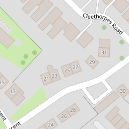


Leaflet © OpenStreetMap contributors
The heatmap indicates the level of crime in the area. The color of the heatmap indicates the crime severity and recency.
Metrics Year-on-Year
- Average area value
- 262,691.00 £Decreased by 1.93 %
- Average area rental value
- 1,023.00 £/moDecreased by 5.71 %
- Est rental Yield
- 4.67 %Decreased by 3.91 %
- Crime Rate
- 2.00 %Unchanged by 0.00 %
from 267,848.00 £
from 1,085.00 £/mo
from 4.86 %
from 2.00 %
Nearby Schools
| Name | Type | Ofsted | Distance |
|---|---|---|---|
| Thornhill Primary School | Academy Converter | 0.89 KM | |
| Itchen College | Further Education | Requires improvement | 0.94 KM |
| St Monica Primary School | Academy Sponsor Led | 1.01 KM | |
| Sholing Infant School | Academy Converter | 1.03 KM | |
| Sholing Junior School | Academy Converter | 1.05 KM |
Images
Nearby Streets
| Name | Average Price | Average Sqft | Distance |
|---|---|---|---|
| Hayes Drive | £ 260,000 | 0 | 0.00 KM |
| Butt's Crescent | £ 0 | 0 | 0.00 KM |
| Siddal Close | £ 216,667 | 0 | 0.00 KM |
| Gainsborough Close | £ 0 | 0 | 0.00 KM |
| Butt's Close | £ 240,000 | 0 | 0.00 KM |
Nearby Transport
| Name | NLC | TLC | Distance |
|---|---|---|---|
| Sholing | 5930 | SHO | 1.92 KM |
| Woolston | 5925 | WLS | 3.11 KM |
| Bitterne | 5945 | BTE | 3.38 KM |
| Netley | 5911 | NTL | 3.44 KM |
| Hamble | 5947 | HME | 4.36 KM |
Nearby Listings
| Address | Price | Type | Score | Distance |
|---|---|---|---|---|
| SHOLING! NO FORWARD CHAIN! IMPRESSIVE LOUNGE WITH BAY! | £ 280,000 | BUY | 6 / 10 | 0.01 KM |
| Cleethorpes Road, Sholing, Southampton, SO19 | £ 350,000 | BUY | 7 / 10 | 0.04 KM |
| Coalville Road, Southampton | £ 325,000 | BUY | 6 / 10 | 0.05 KM |
| SHOLING! NO CHAIN! VERSATILE ACCOMMODATION! | £ 280,000 | BUY | 6 / 10 | 0.05 KM |
| Drove Road, Sholing, SO19 | £ 280,000 | BUY | Unknown | 0.10 KM |
Nearby Properties
| Address | Price | Distance |
|---|---|---|
| 10 Drove Road | £ 178,848 | 0.00 KM |
| 4 Drove Road | £ 193,000 | 0.00 KM |
| 20 Drove Road | £ 360,000 | 0.00 KM |
| 2 Drove Road | £ 223,000 | 0.00 KM |
| 8 Drove Road | £ 230,000 | 0.00 KM |