UN
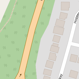
39 Hoppers Way
£ 87,750
Description
We don't have a Description for this property.
- Bedrooms
- 3
- Bathrooms
- 0


Leaflet © OpenStreetMap contributors
The heatmap indicates the level of crime in the area. The color of the heatmap indicates the crime severity and recency.
Metrics Year-on-Year
- Average area value
- 257,097.00 £Decreased by 8.25 %
- Average area rental value
- 956.00 £/moIncreased by 1.92 %
- Est rental Yield
- 4.46 %Increased by 10.95 %
- Crime Rate
- 4.00 %Unchanged by 0.00 %
from 280,201.00 £
from 938.00 £/mo
from 4.02 %
from 4.00 %
Nearby Schools
| Name | Type | Ofsted | Distance |
|---|---|---|---|
| Great Chart Primary School | Community School | Outstanding | 0.52 KM |
| The Wyvern School (Buxford) | Foundation Special School | Good | 0.68 KM |
| The John Wesley Church Of England Methodist Voluntary Aided Primary School | Voluntary Aided School | Good | 0.99 KM |
| Godinton Primary School | Academy Converter | Good | 1.30 KM |
| Beaver Green Primary School | Academy Sponsor Led | Good | 1.44 KM |
Images
Nearby Streets
| Name | Average Price | Average Sqft | Distance |
|---|---|---|---|
| Great Chart Bypass | £ 0 | 0 | 0.00 KM |
| Rowan Close | £ 0 | 0 | 0.00 KM |
| Summerhill | £ 0 | 0 | 0.00 KM |
| Aspen Drive | £ 0 | 0 | 0.00 KM |
| Lilac Court | £ 0 | 0 | 0.00 KM |
Nearby Transport
| Name | NLC | TLC | Distance |
|---|---|---|---|
| Ashford International | 5004 | AFK | 4.09 KM |
| Ham Street | 5037 | HMT | 8.45 KM |
| Charing (Kent) | 5097 | CHG | 9.06 KM |
Nearby Listings
| Address | Price | Type | Score | Distance |
|---|---|---|---|---|
| Hoppers Way, Ashford, Kent | £ 375,000 | BUY | Unknown | 0.02 KM |
| Dragonfly Close, Ashford | £ 310,000 | BUY | 7 / 10 | 0.22 KM |
| Dragonfly Close, Ashford TN23 | £ 260,000 | BUY | 7 / 10 | 0.22 KM |
| Dragonfly Close, Ashford, Kent, TN23 | £ 500,000 | BUY | Unknown | 0.23 KM |
| Grey Willow Gardens, Ashford, TN23 | £ 300,000 | BUY | 7 / 10 | 0.30 KM |
Nearby Properties
| Address | Price | Distance |
|---|---|---|
| 39 Hoppers Way | £ 87,750 | 0.00 KM |
| 35 Hoppers Way | £ 213,000 | 0.00 KM |
| 5 Hoppers Way | £ 281,000 | 0.00 KM |
| 14 Hoppers Way | £ 230,000 | 0.00 KM |
| 8 Hoppers Way | £ 295,000 | 0.00 KM |