UN
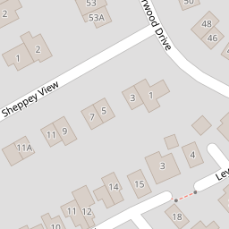
1 Sheppey View
£ 240,000
Description
We don't have a Description for this property.
- Bedrooms
- 4
- Bathrooms
- 0


Leaflet © OpenStreetMap contributors
The heatmap indicates the level of crime in the area. The color of the heatmap indicates the crime severity and recency.
Metrics Year-on-Year
- Average area value
- 355,329.00 £Decreased by 12.56 %
- Average area rental value
- 1,374.00 £/moIncreased by 19.48 %
- Est rental Yield
- 4.64 %Increased by 36.47 %
- Crime Rate
- 1.00 %Unchanged by 0.00 %
from 406,350.00 £
from 1,150.00 £/mo
from 3.40 %
from 1.00 %
Nearby Schools
| Name | Type | Ofsted | Distance |
|---|---|---|---|
| Joy Lane Primary Foundation School | Foundation School | Good | 0.66 KM |
| Joy Lane Children'S Centre | Children's Centre | 0.74 KM | |
| St Alphege Church Of England Infant School | Voluntary Controlled School | Good | 1.75 KM |
| Whitstable Junior School | Foundation School | Good | 1.75 KM |
| Whitstable And Seasalter Endowed Church Of England Junior School | Voluntary Aided School | Outstanding | 2.02 KM |
Images
Nearby Streets
| Name | Average Price | Average Sqft | Distance |
|---|---|---|---|
| The Heights | £ 350,000 | 0 | 0.00 KM |
| Sunray Avenue (CW75) | £ 300,000 | 0 | 0.00 KM |
| Millers Court | £ 0 | 0 | 0.00 KM |
| Ivydene Avenue | £ 0 | 0 | 0.00 KM |
| Alexandra Road (CW54A) | £ 837,500 | 0 | 0.00 KM |
Nearby Transport
| Name | NLC | TLC | Distance |
|---|---|---|---|
| Whitstable | 5196 | WHI | 2.55 KM |
| Chestfield And Swalecliffe | 5200 | CSW | 6.04 KM |
| Canterbury West | 5007 | CBW | 9.40 KM |
| Chartham | 5008 | CRT | 9.63 KM |
Nearby Listings
| Address | Price | Type | Score | Distance |
|---|---|---|---|---|
| Swallow Avenue, Whitstable | £ 365,000 | BUY | 6 / 10 | 0.16 KM |
| Warden Point Way, Whitstable | £ 410,000 | BUY | Unknown | 0.16 KM |
| Swallow Avenue, Whitstable, Kent | £ 450,000 | BUY | Unknown | 0.19 KM |
| Pollard Place, Whitstable, Kent | £ 600,000 | BUY | Unknown | 0.19 KM |
| Grimthorpe Avenue, Whitstable, Kent | £ 281,000 | BUY | 6 / 10 | 0.20 KM |
Nearby Properties
| Address | Price | Distance |
|---|---|---|
| 3 Sheppey View | £ 390,000 | 0.00 KM |
| 11a Sheppey View | £ 198,000 | 0.00 KM |
| 19 Sheppey View | £ 210,000 | 0.00 KM |
| 1 Sheppey View | £ 240,000 | 0.00 KM |
| 14 Sand End | £ 212,450 | 0.07 KM |