UN
31 Castle Row
£ 420,000
Description
We don't have a Description for this property.
- Bedrooms
- 3
- Bathrooms
- 0


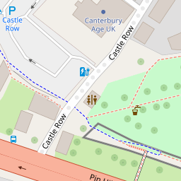


Leaflet © OpenStreetMap contributors
The heatmap indicates the level of crime in the area. The color of the heatmap indicates the crime severity and recency.
Metrics Year-on-Year
- Average area value
- 258,798.00 £Decreased by 0.12 %
- Average area rental value
- 1,121.00 £/moDecreased by 6.97 %
- Est rental Yield
- 5.20 %Decreased by 6.81 %
- Crime Rate
- 28.00 %Unchanged by 0.00 %
from 259,119.00 £
from 1,205.00 £/mo
from 5.58 %
from 28.00 %
Nearby Schools
| Name | Type | Ofsted | Distance |
|---|---|---|---|
| St Peter'S Methodist Primary School | Voluntary Controlled School | Good | 0.44 KM |
| The Orchard School | Foundation Special School | Good | 0.70 KM |
| St Nicholas' School | Community Special School | Good | 0.75 KM |
| Little Hands Children'S Centre | Children's Centre | 0.94 KM | |
| Wincheap Foundation Primary School | Foundation School | Good | 0.97 KM |
Images
Nearby Streets
| Name | Average Price | Average Sqft | Distance |
|---|---|---|---|
| Greyfriars Lane | £ 600,000 | 0 | 0.00 KM |
| St. John's Court | £ 0 | 0 | 0.00 KM |
| City Wall | £ 0 | 0 | 0.00 KM |
| St. Mary's Court | £ 350,000 | 0 | 0.00 KM |
| St George's Lane | £ 165,000 | 0 | 0.00 KM |
Nearby Transport
| Name | NLC | TLC | Distance |
|---|---|---|---|
| Canterbury East | 5164 | CBE | 0.19 KM |
| Canterbury West | 5007 | CBW | 0.94 KM |
| Sturry | 5029 | STU | 5.80 KM |
| Chartham | 5008 | CRT | 6.77 KM |
| Bekesbourne | 5198 | BKS | 6.87 KM |
Nearby Listings
| Address | Price | Type | Score | Distance |
|---|---|---|---|---|
| St. Mary's Street, Canterbury, Kent | £ 280,000 | BUY | Unknown | 0.09 KM |
| Castle Street, Canterbury | £ 370,000 | BUY | 7 / 10 | 0.10 KM |
| Dane John Court, Canterbury | £ 375,000 | BUY | Unknown | 0.11 KM |
| St. Marys Street, Canterbury, CT1 | £ 750,000 | BUY | 7 / 10 | 0.13 KM |
| Dane John Court, Canterbury | £ 475,000 | BUY | 8 / 10 | 0.14 KM |
Nearby Properties
| Address | Price | Distance |
|---|---|---|
| 23 Castle Row | £ 139,950 | 0.00 KM |
| 24 Castle Row | £ 220,000 | 0.00 KM |
| 31 Castle Row | £ 420,000 | 0.00 KM |
| 38 Castle Row | £ 375,000 | 0.00 KM |
| 32 Castle Row | £ 499,995 | 0.00 KM |