UN
4 Nursery Close
£ 209,000
Description
We don't have a Description for this property.
- Bedrooms
- 3
- Bathrooms
- 0
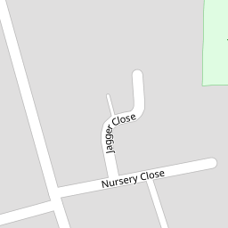

Leaflet © OpenStreetMap contributors
The heatmap indicates the level of crime in the area. The color of the heatmap indicates the crime severity and recency.
Metrics Year-on-Year
- Average area value
- 869,722.00 £Increased by 64.54 %
- Average area rental value
- 1,599.00 £/moDecreased by 40.13 %
- Est rental Yield
- 2.21 %Decreased by 63.53 %
- Crime Rate
- 10.00 %Unchanged by 0.00 %
from 528,583.00 £
from 2,671.00 £/mo
from 6.06 %
from 10.00 %
Nearby Schools
| Name | Type | Ofsted | Distance |
|---|---|---|---|
| The Brent Primary School | Academy Converter | Outstanding | 0.32 KM |
| Stone Lodge School | Free Schools | 0.58 KM | |
| Fleetdown Primary Academy | Academy Converter | 0.79 KM | |
| The Gateway Primary Academy | Academy Converter | Good | 0.85 KM |
| Stone St Mary'S Cofe Primary School | Academy Converter | Good | 1.41 KM |
Images
Nearby Streets
| Name | Average Price | Average Sqft | Distance |
|---|---|---|---|
| Radfield Drive | £ 325,000 | 0 | 0.00 KM |
| Wiltshire Close | £ 0 | 0 | 0.00 KM |
| Princes Road | £ 415,000 | 0 | 0.00 KM |
| Gore Road | £ 375,000 | 0 | 0.00 KM |
| Watling Street | £ 0 | 0 | 0.00 KM |
Nearby Transport
| Name | NLC | TLC | Distance |
|---|---|---|---|
| Stone Crossing | 5248 | SCG | 2.01 KM |
| Dartford | 5101 | DFD | 3.31 KM |
| Greenhithe For Bluewater | 5138 | GNH | 3.65 KM |
| Purfleet | 7453 | PFL | 4.58 KM |
| Farningham Road | 5105 | FNR | 4.67 KM |
Nearby Listings
| Address | Price | Type | Score | Distance |
|---|---|---|---|---|
| St Johns Road, Dartford, Kent, DA2 | £ 450,000 | BUY | Unknown | 0.15 KM |
| Hill House Road, Dartford, DA2 6HQ | £ 270,000 | BUY | Unknown | 0.17 KM |
| Hill House Road, Dartford, DA2 | £ 325,000 | BUY | 7 / 10 | 0.18 KM |
| The Terraces, Dartford, Kent, DA2 6BX | £ 325,000 | BUY | 6 / 10 | 0.20 KM |
| Hillhouse Road, Dartford, DA2 | £ 270,000 | BUY | 6 / 10 | 0.21 KM |
Nearby Properties
| Address | Price | Distance |
|---|---|---|
| 4 Nursery Close | £ 209,000 | 0.00 KM |
| 27 Almond Road | £ 310,000 | 0.12 KM |
| 24 Almond Road | £ 310,000 | 0.12 KM |
| 34 Almond Road | £ 250,000 | 0.12 KM |
| 1 Almond Road | £ 315,000 | 0.12 KM |