UN
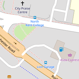
217 Rochester Road
£ 160,000
Description
We don't have a Description for this property.
- Bedrooms
- 2
- Bathrooms
- 0

Leaflet © OpenStreetMap contributors
The heatmap indicates the level of crime in the area. The color of the heatmap indicates the crime severity and recency.
Metrics Year-on-Year
- Average area value
- 249,300.00 £Decreased by 3.97 %
- Average area rental value
- 1,120.00 £/moDecreased by 0.53 %
- Est rental Yield
- 5.39 %Increased by 3.65 %
- Crime Rate
- 13.00 %Unchanged by 0.00 %
from 259,597.00 £
from 1,126.00 £/mo
from 5.20 %
from 13.00 %
Nearby Schools
| Name | Type | Ofsted | Distance |
|---|---|---|---|
| Link19 College | Special Post 16 Institution | 0.19 KM | |
| Westcourt Primary School | Academy Converter | Good | 0.41 KM |
| North West Kent Alternative Provision Service | Academy Alternative Provision Sponsor Led | 0.51 KM | |
| Riverside Children'S Centre (Gravesend) | Children's Centre | 0.58 KM | |
| Thamesview School | Foundation School | Good | 0.99 KM |
Images
Nearby Streets
| Name | Average Price | Average Sqft | Distance |
|---|---|---|---|
| West Court Lane | £ 500,000 | 0 | 0.00 KM |
| Oxford Close | £ 305,000 | 0 | 0.00 KM |
| St. Chad's Drive | £ 299,500 | 0 | 0.00 KM |
| Dalefield Way | £ 180,000 | 0 | 0.00 KM |
| Saint Dunstan's Drive | £ 375,000 | 0 | 0.00 KM |
Nearby Transport
| Name | NLC | TLC | Distance |
|---|---|---|---|
| Gravesend | 5172 | GRV | 3.42 KM |
| Sole Street | 5126 | SOR | 5.75 KM |
| Tilbury Town | 7462 | TIL | 5.76 KM |
| East Tilbury | 7471 | ETL | 6.21 KM |
| Meopham | 5116 | MEP | 6.63 KM |
Nearby Listings
| Address | Price | Type | Score | Distance |
|---|---|---|---|---|
| Rochester Road, Gravesend, Kent, DA12 | £ 325,000 | BUY | 6 / 10 | 0.21 KM |
| Hampton Crescent, Gravesend, Kent, DA12 | £ 325,000 | BUY | 5 / 10 | 0.24 KM |
| Lower Higham Road, Gravesend, Kent, DA12 | £ 475,000 | BUY | 5 / 10 | 0.28 KM |
| Barr Road, Gravesend, Kent | £ 475,000 | BUY | Unknown | 0.32 KM |
| Ingoldsby Road, Gravesend, Kent, DA12 | £ 280,000 | BUY | 5 / 10 | 0.34 KM |
Nearby Properties
| Address | Price | Distance |
|---|---|---|
| 191 Rochester Road | £ 185,000 | 0.00 KM |
| 217 Rochester Road | £ 160,000 | 0.00 KM |
| 227 Rochester Road | £ 125,000 | 0.00 KM |
| 223 Rochester Road | £ 173,000 | 0.02 KM |
| 219 Rochester Road | £ 192,000 | 0.02 KM |