UN
32 Tower Lane
£ 595,000
Description
We don't have a Description for this property.
- Bedrooms
- 4
- Bathrooms
- 0

Leaflet © OpenStreetMap contributors
The heatmap indicates the level of crime in the area. The color of the heatmap indicates the crime severity and recency.
Metrics Year-on-Year
- Average area value
- 549,367.00 £Increased by 10.64 %
- Average area rental value
- 1,472.00 £/moIncreased by 5.90 %
- Est rental Yield
- 3.22 %Decreased by 4.17 %
- Crime Rate
- 1.00 %Unchanged by 0.00 %
from 496,546.00 £
from 1,390.00 £/mo
from 3.36 %
from 1.00 %
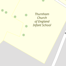
Nearby Schools
| Name | Type | Ofsted | Distance |
|---|---|---|---|
| Thurnham Church Of England Infant School | Voluntary Controlled School | Outstanding | 0.13 KM |
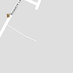
| Roseacre Junior School | Foundation School | Outstanding | 0.21 KM |
| Madginford Primary School | Community School | Good | 1.09 KM |
| Snowfields Academy | Free Schools Special | 1.76 KM | |
| Bearsted Primary Academy | Free Schools | 1.76 KM |
Images
Nearby Streets
| Name | Average Price | Average Sqft | Distance |
|---|---|---|---|
| Roseacre Gardens | £ 701,000 | 0 | 0.00 KM |
| Tower Gardens | £ 850,000 | 0 | 0.00 KM |
| Nursery Avenue | £ 0 | 0 | 0.00 KM |
| St. Faith's Lane | £ 0 | 0 | 0.00 KM |
| Pimpernel Close | £ 850,000 | 0 | 0.00 KM |
Nearby Transport
| Name | NLC | TLC | Distance |
|---|---|---|---|
| Bearsted | 5091 | BSD | 0.85 KM |
| Maidstone East | 5115 | MDE | 5.61 KM |
| Maidstone West | 5222 | MDW | 6.17 KM |
| Hollingbourne | 5141 | HBN | 6.26 KM |
| Maidstone Barracks | 5237 | MDB | 6.40 KM |
Nearby Listings
| Address | Price | Type | Score | Distance |
|---|---|---|---|---|
| Roseacre Gardens, Bearsted, Maidstone | £ 800,000 | BUY | Unknown | 0.10 KM |
| Roseacre Gardens, Bearsted, Maidstone | £ 775,000 | BUY | 7 / 10 | 0.11 KM |
| Roseacre Gardens, Bearsted, Maidstone, Kent | £ 800,000 | BUY | 7 / 10 | 0.14 KM |
| Roseacre Lane, Bearsted, Maidstone | £ 925,000 | BUY | Unknown | 0.16 KM |
| Roseacre Lane, Bearsted, Maidstone | £ 950,000 | BUY | 8 / 10 | 0.17 KM |
Nearby Properties
| Address | Price | Distance |
|---|---|---|
| 32 Tower Lane | £ 595,000 | 0.00 KM |
| 21 Tower Lane | £ 637,500 | 0.00 KM |
| Briarwood | £ 1,150,000 | 0.00 KM |
| 24 Tower Lane | £ 417,000 | 0.00 KM |
| 33 Tower Lane | £ 135,000 | 0.00 KM |