UN
4 Larchwood Close
£ 140,000
Description
We don't have a Description for this property.
- Bedrooms
- 2
- Bathrooms
- 0


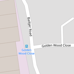

Leaflet © OpenStreetMap contributors
The heatmap indicates the level of crime in the area. The color of the heatmap indicates the crime severity and recency.
Metrics Year-on-Year
- Average area value
- 489,321.00 £Increased by 10.44 %
- Average area rental value
- 1,646.00 £/moDecreased by 0.60 %
- Est rental Yield
- 4.04 %Decreased by 10.02 %
- Crime Rate
- 35.00 %Unchanged by 0.00 %
from 443,061.00 £
from 1,656.00 £/mo
from 4.49 %
from 35.00 %
Nearby Schools
| Name | Type | Ofsted | Distance |
|---|---|---|---|
| Swingate Primary School | Community School | Good | 0.54 KM |
| St Benedict'S Catholic Primary School | Voluntary Aided School | Good | 0.95 KM |
| Lordswood Children'S Centre | Children's Centre | 1.72 KM | |
| Lordswood School | Academy Sponsor Led | Good | 1.72 KM |
| Walderslade Primary School | Academy Converter | Good | 2.67 KM |
Images
Nearby Streets
| Name | Average Price | Average Sqft | Distance |
|---|---|---|---|
| Sandpiper Road | £ 282,000 | 0 | 0.00 KM |
| Ascot Close | £ 475,000 | 0 | 0.00 KM |
| Neil's Bombhole of Death | £ 525,000 | 0 | 0.00 KM |
| Badger Road | £ 350,000 | 0 | 0.00 KM |
| Norfolk Close | £ 290,000 | 0 | 0.00 KM |
Nearby Transport
| Name | NLC | TLC | Distance |
|---|---|---|---|
| Gillingham (Kent) | 5169 | GLM | 6.24 KM |
| Chatham | 5199 | CTM | 6.36 KM |
| Maidstone East | 5115 | MDE | 6.62 KM |
| Bearsted | 5091 | BSD | 6.85 KM |
| Maidstone Barracks | 5237 | MDB | 7.10 KM |
Nearby Listings
| Address | Price | Type | Score | Distance |
|---|---|---|---|---|
| Larch Wood Close, Chatham, Kent, ME5 | £ 200,000 | BUY | 5 / 10 | 0.00 KM |
| Conifer Drive, Lords Wood, Chatham, Kent | £ 185,500 | BUY | 6 / 10 | 0.07 KM |
| Conifer Drive, Lords Wood, Chatham, Kent | £ 280,000 | BUY | 6 / 10 | 0.07 KM |
| FIR TREE GROVE, CHATHAM, ME5 | £ 280,000 | BUY | Unknown | 0.10 KM |
| Fir Tree Grove, Chatham, Kent, ME5 | £ 180,000 | BUY | 4 / 10 | 0.10 KM |
Nearby Properties
| Address | Price | Distance |
|---|---|---|
| 11 Larchwood Close | £ 148,000 | 0.00 KM |
| 4 Larchwood Close | £ 140,000 | 0.00 KM |
| 19 Larchwood Close | £ 132,000 | 0.00 KM |
| 17 Larchwood Close | £ 240,000 | 0.00 KM |
| 24 Larchwood Close | £ 145,500 | 0.00 KM |