UN
Lorina
£ 377,500
Description
We don't have a Description for this property.
- Bedrooms
- 4
- Bathrooms
- 0


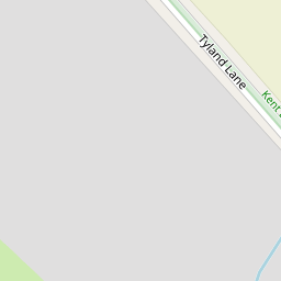

Leaflet © OpenStreetMap contributors
The heatmap indicates the level of crime in the area. The color of the heatmap indicates the crime severity and recency.
Metrics Year-on-Year
- Average area value
- 489,321.00 £Increased by 10.44 %
- Average area rental value
- 1,646.00 £/moDecreased by 0.60 %
- Est rental Yield
- 4.04 %Decreased by 10.02 %
- Crime Rate
- 7.00 %Unchanged by 0.00 %
from 443,061.00 £
from 1,656.00 £/mo
from 4.49 %
from 7.00 %
Nearby Schools
| Name | Type | Ofsted | Distance |
|---|---|---|---|
| Sandling Primary School | Community School | Good | 1.86 KM |
| St Paul'S Infant School | Community School | Good | 2.06 KM |
| North Borough Junior School | Community School | Good | 2.07 KM |
| Howard De Walden Children'S Centre | Children's Centre | 2.61 KM | |
| Maidstone Grammar School For Girls | Foundation School | Outstanding | 2.65 KM |
Images
Nearby Streets
| Name | Average Price | Average Sqft | Distance |
|---|---|---|---|
| Old Chatham Road | £ 600,000 | 0 | 0.00 KM |
| Royal Engineers' Road | £ 166,556 | 0 | 0.00 KM |
| Castle View | £ 495,500 | 0 | 0.00 KM |
| Egerton Road | £ 290,000 | 0 | 0.00 KM |
| MR464A | £ 650,000 | 0 | 0.00 KM |
Nearby Transport
| Name | NLC | TLC | Distance |
|---|---|---|---|
| Maidstone East | 5115 | MDE | 2.77 KM |
| Maidstone Barracks | 5237 | MDB | 2.88 KM |
| Maidstone West | 5222 | MDW | 3.59 KM |
| Barming | 5133 | BMG | 4.84 KM |
| Aylesford | 5162 | AYL | 5.84 KM |
Nearby Listings
| Address | Price | Type | Score | Distance |
|---|---|---|---|---|
| Tyland Lane, Sandling, Maidstone | £ 450,000 | BUY | Unknown | 0.07 KM |
| Shenley Grove, Sandling, ME14 | £ 450,000 | BUY | 7 / 10 | 0.11 KM |
| Chatham Road, Maidstone, ME14 | £ 400,000 | BUY | 7 / 10 | 0.46 KM |
| Chatham Road, Maidstone, ME14 | £ 700,000 | BUY | 7 / 10 | 0.48 KM |
| Chatham Road, Sandling, Maidstone, Kent | £ 525,000 | BUY | 7 / 10 | 0.49 KM |