UN
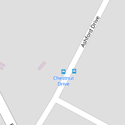
10 Chestnut Drive
£ 279,000
Description
We don't have a Description for this property.
- Bedrooms
- 4
- Bathrooms
- 0


Leaflet © OpenStreetMap contributors
The heatmap indicates the level of crime in the area. The color of the heatmap indicates the crime severity and recency.
Metrics Year-on-Year
- Average area value
- 621,053.00 £Decreased by 6.91 %
- Average area rental value
- 2,111.00 £/moIncreased by 9.10 %
- Est rental Yield
- 4.08 %Increased by 17.24 %
- Crime Rate
- 62.00 %Unchanged by 0.00 %
from 667,129.00 £
from 1,935.00 £/mo
from 3.48 %
from 62.00 %
Nearby Schools
| Name | Type | Ofsted | Distance |
|---|---|---|---|
| Kingswood Primary School | Community School | Good | 0.66 KM |
| Ulcombe Church Of England Primary School | Voluntary Controlled School | Good | 2.64 KM |
| Leeds And Broomfield Church Of England Primary School | Voluntary Controlled School | Good | 3.00 KM |
| Hollingbourne Primary School | Community School | Good | 4.01 KM |
| Sutton Valence School | Other Independent School | 4.18 KM |
Images
Nearby Transport
| Name | NLC | TLC | Distance |
|---|---|---|---|
| Hollingbourne | 5141 | HBN | 4.13 KM |
| Harrietsham | 5140 | HRM | 5.17 KM |
| Headcorn | 5220 | HCN | 6.95 KM |
| Bearsted | 5091 | BSD | 7.76 KM |
| Lenham | 5111 | LEN | 8.77 KM |
Nearby Listings
| Address | Price | Type | Score | Distance |
|---|---|---|---|---|
| Chestnut Drive, Kingswood, Maidstone | £ 500,000 | BUY | Unknown | 0.09 KM |
| Laurel Grove, Kingswood, Maidstone, Kent | £ 500,000 | BUY | 6 / 10 | 0.13 KM |
| Chestnut Drive, Kingswood, ME17 | £ 310,000 | BUY | Unknown | 0.13 KM |
| Charlesford Avenue, Maidstone | £ 450,000 | BUY | Unknown | 0.16 KM |
| Elder Close, Kingswood, Maidstone, Kent, ME17 | £ 350,000 | BUY | 7 / 10 | 0.20 KM |
Nearby Properties
| Address | Price | Distance |
|---|---|---|
| 6 Chestnut Drive | £ 275,000 | 0.00 KM |
| 11 Chestnut Drive | £ 495,000 | 0.00 KM |
| 10 Chestnut Drive | £ 279,000 | 0.00 KM |
| 14 Chestnut Drive | £ 106,000 | 0.00 KM |
| 13 Chestnut Drive | £ 281,500 | 0.00 KM |