UN
2 Stratford Drive
£ 170,000
Description
We don't have a Description for this property.
- Bedrooms
- 2
- Bathrooms
- 0


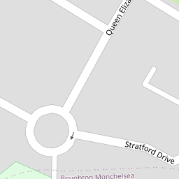

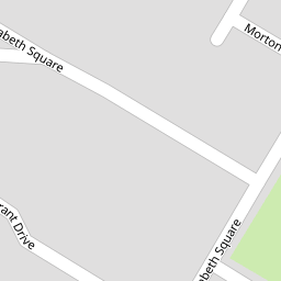


Leaflet © OpenStreetMap contributors
The heatmap indicates the level of crime in the area. The color of the heatmap indicates the crime severity and recency.
Metrics Year-on-Year
- Average area value
- 331,107.00 £Increased by 20.97 %
- Average area rental value
- 1,555.00 £/moDecreased by 1.58 %
- Est rental Yield
- 5.64 %Decreased by 18.61 %
- Crime Rate
- 15.00 %Unchanged by 0.00 %
from 273,708.00 £
from 1,580.00 £/mo
from 6.93 %
from 15.00 %
Nearby Schools
| Name | Type | Ofsted | Distance |
|---|---|---|---|
| Molehill Primary Academy | Academy Sponsor Led | Good | 0.58 KM |
| The Meadow Children'S Centre | Children's Centre | 0.70 KM | |
| Oaks Primary Academy | Academy Sponsor Led | Outstanding | 0.94 KM |
| Tree Tops Primary Academy | Academy Sponsor Led | Good | 1.14 KM |
| The Holy Family Catholic Primary School | Academy Sponsor Led | Requires improvement | 1.35 KM |
Images
Nearby Streets
| Name | Average Price | Average Sqft | Distance |
|---|---|---|---|
| Morton Close | £ 425,000 | 0 | 0.00 KM |
| St. Saviours Road | £ 0 | 0 | 0.00 KM |
| Woodside Road | £ 0 | 0 | 0.00 KM |
| Lincoln Road | £ 387,500 | 0 | 0.00 KM |
| Sutton Road | £ 384,750 | 0 | 0.00 KM |
Nearby Transport
| Name | NLC | TLC | Distance |
|---|---|---|---|
| Maidstone West | 5222 | MDW | 4.39 KM |
| Maidstone East | 5115 | MDE | 4.57 KM |
| Bearsted | 5091 | BSD | 4.92 KM |
| Maidstone Barracks | 5237 | MDB | 5.04 KM |
| East Farleigh | 5234 | EFL | 6.86 KM |
Nearby Listings
| Address | Price | Type | Score | Distance |
|---|---|---|---|---|
| Stratford Drive, Maidstone, Kent, ME15 | £ 280,000 | BUY | 7 / 10 | 0.00 KM |
| Stratford Drive, Maidstone, ME15 | £ 290,000 | BUY | 6 / 10 | 0.01 KM |
| Stratford Drive, Maidstone | £ 350,000 | BUY | 7 / 10 | 0.04 KM |
| Stratford Drive, Maidstone | £ 375,000 | BUY | Unknown | 0.09 KM |
| Mansfield Place, Maidstone, ME15 | £ 325,000 | BUY | Unknown | 0.14 KM |
Nearby Properties
| Address | Price | Distance |
|---|---|---|
| 31 Stratford Drive | £ 140,000 | 0.00 KM |
| 2 Stratford Drive | £ 170,000 | 0.00 KM |
| 23 Stratford Drive | £ 178,500 | 0.00 KM |
| 15 Stratford Drive | £ 225,000 | 0.00 KM |
| 25 Stratford Drive | £ 355,000 | 0.00 KM |