UN
60 Mill Road
£ 410,000
Description
We don't have a Description for this property.
- Bedrooms
- 4
- Bathrooms
- 0
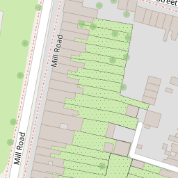

Leaflet © OpenStreetMap contributors
The heatmap indicates the level of crime in the area. The color of the heatmap indicates the crime severity and recency.
Metrics Year-on-Year
- Average area value
- 243,721.00 £Increased by 0.20 %
- Average area rental value
- 1,192.00 £/moDecreased by 6.95 %
- Est rental Yield
- 5.87 %Decreased by 7.12 %
- Crime Rate
- 6.00 %Unchanged by 0.00 %
from 243,234.00 £
from 1,281.00 £/mo
from 6.32 %
from 6.00 %
Nearby Schools
| Name | Type | Ofsted | Distance |
|---|---|---|---|
| Midkent College | Further Education | Good | 0.24 KM |
| Oasis Academy Skinner Street | Academy Sponsor Led | Good | 0.50 KM |
| Burnt Oak Primary School & Children'S Centre | Children's Centre | 0.76 KM | |
| Burnt Oak Primary School | Community School | Requires improvement | 0.76 KM |
| Waterfront Utc | University Technical College | 0.85 KM |
Images
Nearby Streets
| Name | Average Price | Average Sqft | Distance |
|---|---|---|---|
| Khyber Road | £ 0 | 0 | 0.00 KM |
| Pheonix Court | £ 0 | 0 | 0.00 KM |
| Kestrel House | £ 0 | 0 | 0.00 KM |
| Park View | £ 0 | 0 | 0.00 KM |
| Purser Way | £ 0 | 0 | 0.00 KM |
Nearby Transport
| Name | NLC | TLC | Distance |
|---|---|---|---|
| Gillingham (Kent) | 5169 | GLM | 0.96 KM |
| Chatham | 5199 | CTM | 2.75 KM |
| Rochester | 5203 | RTR | 3.70 KM |
| Strood (Kent) | 5191 | SOO | 4.77 KM |
| Rainham (Kent) | 5177 | RAI | 8.07 KM |
Nearby Listings
| Address | Price | Type | Score | Distance |
|---|---|---|---|---|
| Saunders Street, Gillingham, Kent, ME7 | £ 260,000 | BUY | 6 / 10 | 0.07 KM |
| Mill Road, Gillingham, Kent, ME7 | £ 280,000 | BUY | 7 / 10 | 0.09 KM |
| Saunders Street, Gillingham, Kent | £ 240,000 | BUY | 5 / 10 | 0.10 KM |
| Saunders Street, Gillingham, Kent | £ 145,500 | BUY | 4 / 10 | 0.10 KM |
| Saunders Street, Gillingham, Kent | £ 220,000 | BUY | 5 / 10 | 0.10 KM |
Nearby Properties
| Address | Price | Distance |
|---|---|---|
| 56 Mill Road | £ 198,000 | 0.00 KM |
| 57a Mill Road | £ 45,000 | 0.00 KM |
| 52 Mill Road | £ 197,500 | 0.00 KM |
| 60 Mill Road | £ 410,000 | 0.00 KM |
| 57 Mill Road | £ 170,000 | 0.01 KM |