UN
43b Church Street
£ 185,000
Description
We don't have a Description for this property.
- Bedrooms
- 2
- Bathrooms
- 0

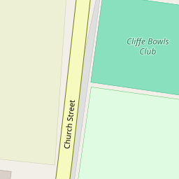


Leaflet © OpenStreetMap contributors
The heatmap indicates the level of crime in the area. The color of the heatmap indicates the crime severity and recency.
Metrics Year-on-Year
- Average area value
- 397,500.00 £Decreased by 6.87 %
- Average area rental value
- 1,383.00 £/moDecreased by 19.36 %
- Est rental Yield
- 4.18 %Decreased by 13.28 %
- Crime Rate
- 92.00 %Unchanged by 0.00 %
from 426,822.00 £
from 1,715.00 £/mo
from 4.82 %
from 92.00 %
Nearby Schools
| Name | Type | Ofsted | Distance |
|---|---|---|---|
| St Helen'S Church Of England Primary School, Cliffe | Voluntary Controlled School | Good | 0.50 KM |
| City Of Rochester School | Other Independent Special School | Inadequate | 2.28 KM |
| Cliffe Woods Primary School | Academy Converter | Outstanding | 2.29 KM |
| Higham Primary School | Community School | Good | 4.97 KM |
| Chattenden Primary School | Academy Converter | Good | 5.24 KM |
Images
Nearby Streets
| Name | Average Price | Average Sqft | Distance |
|---|---|---|---|
| Norwood Close | £ 0 | 0 | 0.00 KM |
| Old Rectory Road | £ 0 | 0 | 0.00 KM |
| Pickle's Way | £ 0 | 0 | 0.00 KM |
| Common Lane | £ 0 | 0 | 0.00 KM |
Nearby Transport
| Name | NLC | TLC | Distance |
|---|---|---|---|
| Higham | 5202 | HGM | 4.48 KM |
| Strood (Kent) | 5191 | SOO | 6.42 KM |
| Rochester | 5203 | RTR | 7.79 KM |
| Chatham | 5199 | CTM | 8.66 KM |
| Gillingham (Kent) | 5169 | GLM | 9.59 KM |
Nearby Listings
| Address | Price | Type | Score | Distance |
|---|---|---|---|---|
| Norwood Close, Cliffe, Rochester, Kent, ME3 | £ 450,000 | BUY | 7 / 10 | 0.11 KM |
| New Road, Cliffe, ME3 | £ 320,000 | BUY | 7 / 10 | 0.20 KM |
| Church Street, Cliffe, Rochester, Kent. ME3 | £ 350,000 | BUY | 6 / 10 | 0.22 KM |
| Millcroft Road, Cliffe | £ 325,000 | BUY | Unknown | 0.37 KM |
| Cooling Road, Cliffe, Rochester | £ 500,000 | BUY | 7 / 10 | 0.54 KM |
Nearby Properties
| Address | Price | Distance |
|---|---|---|
| 43b Church Street | £ 185,000 | 0.00 KM |
| 5 Church Street | £ 175,000 | 0.00 KM |
| 51 Church Street | £ 220,500 | 0.00 KM |
| 25 Church Street | £ 205,000 | 0.00 KM |
| 13 Church Street | £ 230,000 | 0.00 KM |