UN
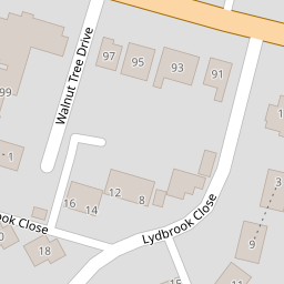
6 Walnut Tree Drive
£ 180,000
Description
We don't have a Description for this property.
- Bedrooms
- 1
- Bathrooms
- 0


Leaflet © OpenStreetMap contributors
The heatmap indicates the level of crime in the area. The color of the heatmap indicates the crime severity and recency.
Metrics Year-on-Year
- Average area value
- 317,778.00 £Increased by 1.47 %
- Average area rental value
- 1,233.00 £/moIncreased by 2.75 %
- Est rental Yield
- 4.66 %Increased by 1.30 %
- Crime Rate
- 4.00 %Unchanged by 0.00 %
from 313,162.00 £
from 1,200.00 £/mo
from 4.60 %
from 4.00 %
Nearby Schools
| Name | Type | Ofsted | Distance |
|---|---|---|---|
| Westlands Primary School | Academy Converter | Good | 0.50 KM |
| Woodgrove Children'S Centre | Children's Centre | 0.56 KM | |
| Aspire School | Free Schools Special | 0.93 KM | |
| Westlands School | Academy Converter | Good | 0.94 KM |
| St Peter'S Catholic Primary School | Academy Converter | 1.06 KM |
Images
Nearby Streets
| Name | Average Price | Average Sqft | Distance |
|---|---|---|---|
| London Road | £ 0 | 0 | 0.00 KM |
| London Road | £ 243,000 | 0 | 0.00 KM |
| Graylings Court | £ 0 | 0 | 0.00 KM |
| Norwood Walk West | £ 302,500 | 0 | 0.00 KM |
| Newlands Avenue | £ 325,000 | 0 | 0.00 KM |
Nearby Transport
| Name | NLC | TLC | Distance |
|---|---|---|---|
| Sittingbourne | 5187 | SIT | 1.69 KM |
| Kemsley | 5205 | KML | 2.87 KM |
| Newington | 5175 | NGT | 5.76 KM |
| Swale | 5249 | SWL | 6.07 KM |
| Queenborough | 5176 | QBR | 8.84 KM |
Nearby Listings
| Address | Price | Type | Score | Distance |
|---|---|---|---|---|
| Walnut Tree Drive, Sittingbourne, Kent, ME10 | £ 160,000 | BUY | 6 / 10 | 0.01 KM |
| Bourne Grove, Sittingbourne, Kent, ME10 | £ 350,000 | BUY | Unknown | 0.17 KM |
| Bourne Grove, Sittingbourne, Kent | £ 350,000 | BUY | 6 / 10 | 0.18 KM |
| Bourne Grove, Sittingbourne, ME10 | £ 320,000 | BUY | 6 / 10 | 0.19 KM |
| Borden Lane, Sittingbourne, Kent, ME10 | £ 375,000 | BUY | 6 / 10 | 0.19 KM |
Nearby Properties
| Address | Price | Distance |
|---|---|---|
| 6 Walnut Tree Drive | £ 180,000 | 0.00 KM |
| 5 Walnut Tree Drive | £ 135,000 | 0.00 KM |
| 4 Walnut Tree Drive | £ 165,000 | 0.00 KM |
| 32 Lydbrook Close | £ 285,000 | 0.07 KM |
| 26 Lydbrook Close | £ 195,000 | 0.07 KM |