UN
7 Thanet Road
£ 150,000
Description
We don't have a Description for this property.
- Bedrooms
- 2
- Bathrooms
- 0


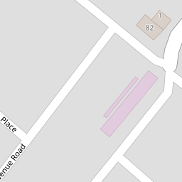
Leaflet © OpenStreetMap contributors
The heatmap indicates the level of crime in the area. The color of the heatmap indicates the crime severity and recency.
Metrics Year-on-Year
- Average area value
- 322,492.00 £Increased by 19.79 %
- Average area rental value
- 1,068.00 £/moIncreased by 7.77 %
- Est rental Yield
- 3.97 %Decreased by 10.18 %
- Crime Rate
- 17.00 %Unchanged by 0.00 %
from 269,222.00 £
from 991.00 £/mo
from 4.42 %
from 17.00 %
Nearby Schools
| Name | Type | Ofsted | Distance |
|---|---|---|---|
| St Ethelbert'S Catholic Primary School | Voluntary Aided School | Good | 0.19 KM |
| Newlands Primary School | Academy Sponsor Led | Good | 0.94 KM |
| Newlands Children'S Centre | Children's Centre | 0.94 KM | |
| Chatham & Clarendon Grammar School | Academy Converter | Good | 1.03 KM |
| Ramsgate, Holy Trinity Church Of England Primary School | Voluntary Aided School | Outstanding | 1.13 KM |
Images
Nearby Streets
| Name | Average Price | Average Sqft | Distance |
|---|---|---|---|
| Mulberry Close | £ 260,000 | 0 | 0.00 KM |
| Thanet Road | £ 231,900 | 0 | 0.00 KM |
| Avenue Road | £ 324,999 | 0 | 0.00 KM |
| Victoria Mews | £ 150,667 | 0 | 0.00 KM |
| Salisbury Avenue | £ 226,100 | 0 | 0.00 KM |
Nearby Transport
| Name | NLC | TLC | Distance |
|---|---|---|---|
| Dumpton Park | 5034 | DMP | 0.80 KM |
| Ramsgate | 5023 | RAM | 2.10 KM |
| Broadstairs | 5006 | BSR | 2.63 KM |
| Margate | 5018 | MAR | 7.87 KM |
Nearby Listings
| Address | Price | Type | Score | Distance |
|---|---|---|---|---|
| Thanet Road, Ramsgate, CT11 | £ 290,000 | BUY | 5 / 10 | 0.01 KM |
| Montefiore Cottages, Ramsgate | £ 240,000 | BUY | 5 / 10 | 0.03 KM |
| Montefiore Cottages, Ramsgate, CT11 | £ 200,000 | BUY | Unknown | 0.04 KM |
| Syndale Place, Ramsgate, Kent, CT11 | £ 220,000 | BUY | 5 / 10 | 0.07 KM |
| Avenue Road, Ramsgate, CT11 | £ 525,000 | BUY | 8 / 10 | 0.11 KM |
Nearby Properties
| Address | Price | Distance |
|---|---|---|
| 7 Thanet Road | £ 150,000 | 0.00 KM |
| 17 Thanet Road | £ 125,000 | 0.00 KM |
| 19 Thanet Road | £ 34,000 | 0.00 KM |
| 5 Thanet Road | £ 220,000 | 0.00 KM |
| 4 Thanet Road | £ 155,000 | 0.00 KM |