UN
7 Briary Close
£ 168,000
Description
We don't have a Description for this property.
- Bedrooms
- 3
- Bathrooms
- 0
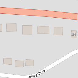

Leaflet © OpenStreetMap contributors
The heatmap indicates the level of crime in the area. The color of the heatmap indicates the crime severity and recency.
Metrics Year-on-Year
- Average area value
- 369,617.00 £Increased by 5.00 %
- Average area rental value
- 1,050.00 £/moIncreased by 8.58 %
- Est rental Yield
- 3.41 %Increased by 3.33 %
- Crime Rate
- 17.00 %Unchanged by 0.00 %
from 352,000.00 £
from 967.00 £/mo
from 3.30 %
from 17.00 %
Nearby Schools
| Name | Type | Ofsted | Distance |
|---|---|---|---|
| Chartfield School | Other Independent School | Good | 0.85 KM |
| St Crispin'S Community Primary Infant School | Community School | Good | 1.31 KM |
| Garlinge Primary School And Nursery | Foundation School | Good | 1.48 KM |
| St Saviour'S Church Of England Junior School | Voluntary Controlled School | Good | 1.58 KM |
| Garlinge Children'S Centre | Children's Centre | 1.70 KM |
Images
Nearby Streets
| Name | Average Price | Average Sqft | Distance |
|---|---|---|---|
| Wentworth Avenue | £ 495,000 | 0 | 0.00 KM |
| Saxon Road | £ 350,000 | 0 | 0.00 KM |
| Read Court | £ 98,071 | 0 | 0.00 KM |
| Beach Road | £ 195,500 | 0 | 0.00 KM |
| Victoria Avenue | £ 295,105 | 0 | 0.00 KM |
Nearby Transport
| Name | NLC | TLC | Distance |
|---|---|---|---|
| Westgate-On-Sea | 5195 | WGA | 1.04 KM |
| Margate | 5018 | MAR | 2.78 KM |
| Birchington-On-Sea | 5163 | BCH | 5.11 KM |
| Minster | 5019 | MSR | 6.54 KM |
| Ramsgate | 5023 | RAM | 7.82 KM |
Nearby Listings
| Address | Price | Type | Score | Distance |
|---|---|---|---|---|
| Briary Close, Margate, Kent, CT9 | £ 300,000 | BUY | 6 / 10 | 0.02 KM |
| Briary Close, Margate, Kent | £ 300,000 | BUY | Unknown | 0.02 KM |
| Canterbury Road, Margate, CT9 | £ 400,000 | BUY | 7 / 10 | 0.05 KM |
| Canterbury Road, Margate | £ 400,000 | BUY | 7 / 10 | 0.05 KM |
| Canterbury Road, Westbrook, Margate | £ 319,950 | BUY | Unknown | 0.09 KM |
Nearby Properties
| Address | Price | Distance |
|---|---|---|
| 7 Briary Close | £ 168,000 | 0.00 KM |
| 30 Briary Close | £ 240,000 | 0.00 KM |
| 31 Briary Close | £ 249,999 | 0.00 KM |
| 34 Briary Close | £ 177,500 | 0.00 KM |
| 8 Briary Close | £ 173,000 | 0.00 KM |