UN
7 King Edward Road
£ 38,000
Description
We don't have a Description for this property.
- Bedrooms
- 3
- Bathrooms
- 0
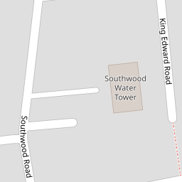

Leaflet © OpenStreetMap contributors
The heatmap indicates the level of crime in the area. The color of the heatmap indicates the crime severity and recency.
Metrics Year-on-Year
- Average area value
- 290,310.00 £Decreased by 2.30 %
- Average area rental value
- 1,186.00 £/moDecreased by 3.81 %
- Est rental Yield
- 4.90 %Decreased by 1.61 %
- Crime Rate
- 15.00 %Unchanged by 0.00 %
from 297,138.00 £
from 1,233.00 £/mo
from 4.98 %
from 15.00 %
Nearby Schools
| Name | Type | Ofsted | Distance |
|---|---|---|---|
| Christ Church Church Of England Junior School, Ramsgate | Academy Sponsor Led | Good | 0.43 KM |
| Ellington Infant School | Community School | Good | 0.43 KM |
| St Laurence In Thanet Church Of England Junior Academy | Academy Sponsor Led | Good | 0.72 KM |
| The Old Priory School | Other Independent Special School | Good | 0.99 KM |
| Priory Infant School | Community School | Good | 1.01 KM |
Images
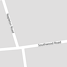
Nearby Streets
| Name | Average Price | Average Sqft | Distance |
|---|---|---|---|
| Mays Road | £ 0 | 0 | 0.00 KM |
| Ellington Road | £ 265,000 | 0 | 0.00 KM |
| Old School Row | £ 380,000 | 0 | 0.00 KM |
| Ellington Place | £ 0 | 0 | 0.00 KM |
| Park View | £ 375,000 | 0 | 0.00 KM |
Nearby Transport
| Name | NLC | TLC | Distance |
|---|---|---|---|
| Ramsgate | 5023 | RAM | 0.86 KM |
| Dumpton Park | 5034 | DMP | 2.81 KM |
| Broadstairs | 5006 | BSR | 4.48 KM |
| Margate | 5018 | MAR | 6.74 KM |
| Westgate-On-Sea | 5195 | WGA | 8.96 KM |
Nearby Listings
| Address | Price | Type | Score | Distance |
|---|---|---|---|---|
| Bloomsbury Road, Ramsgate, CT11 | £ 195,000 | BUY | 5 / 10 | 0.03 KM |
| Herbert Road, Ramsgate, Kent | £ 270,000 | BUY | 6 / 10 | 0.05 KM |
| Bloomsbury Road, Ramsgate | £ 260,000 | BUY | 6 / 10 | 0.07 KM |
| Herbert Road, Ramsgate, CT11 0AS | £ 275,000 | BUY | 7 / 10 | 0.07 KM |
| Napleton Road, Ramsgate, Kent, CT11 | £ 295,000 | BUY | 6 / 10 | 0.09 KM |
Nearby Properties
| Address | Price | Distance |
|---|---|---|
| 5 King Edward Road | £ 178,000 | 0.00 KM |
| 8 King Edward Road | £ 162,000 | 0.00 KM |
| 7 King Edward Road | £ 38,000 | 0.00 KM |
| 14 King Edward Road | £ 170,000 | 0.00 KM |
| 1 King Edward Road | £ 205,000 | 0.00 KM |