UN
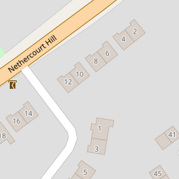
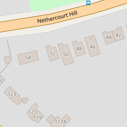
9 Nethercourt Hill
£ 285,000
Description
We don't have a Description for this property.
- Bedrooms
- 3
- Bathrooms
- 0

Leaflet © OpenStreetMap contributors
The heatmap indicates the level of crime in the area. The color of the heatmap indicates the crime severity and recency.
Metrics Year-on-Year
- Average area value
- 279,983.00 £Decreased by 14.38 %
- Average area rental value
- 1,013.00 £/moDecreased by 7.91 %
- Est rental Yield
- 4.34 %Increased by 7.43 %
- Crime Rate
- 1.00 %Unchanged by 0.00 %
from 327,013.00 £
from 1,100.00 £/mo
from 4.04 %
from 1.00 %
Nearby Schools
| Name | Type | Ofsted | Distance |
|---|---|---|---|
| St Laurence In Thanet Church Of England Junior Academy | Academy Sponsor Led | Good | 0.64 KM |
| Ellington Infant School | Community School | Good | 0.72 KM |
| Chilton Primary School | Academy Converter | Outstanding | 0.83 KM |
| Newington Children'S Centre | Children's Centre | 1.00 KM | |
| Christ Church Church Of England Junior School, Ramsgate | Academy Sponsor Led | Good | 1.01 KM |
Images
Nearby Streets
| Name | Average Price | Average Sqft | Distance |
|---|---|---|---|
| Telham Avenue | £ 230,000 | 0 | 0.00 KM |
| Smugglers Close | £ 0 | 0 | 0.00 KM |
| Old School Row | £ 380,000 | 0 | 0.00 KM |
| Mays Road | £ 0 | 0 | 0.00 KM |
| Ellington Place | £ 0 | 0 | 0.00 KM |
Nearby Transport
| Name | NLC | TLC | Distance |
|---|---|---|---|
| Ramsgate | 5023 | RAM | 1.17 KM |
| Dumpton Park | 5034 | DMP | 3.32 KM |
| Broadstairs | 5006 | BSR | 4.89 KM |
| Margate | 5018 | MAR | 6.32 KM |
| Westgate-On-Sea | 5195 | WGA | 8.38 KM |
Nearby Listings
| Address | Price | Type | Score | Distance |
|---|---|---|---|---|
| Nethercourt Hill, Ramsgate | £ 345,000 | BUY | 6 / 10 | 0.08 KM |
| Nethercourt Gardens, Ramsgate, Kent, CT11 | £ 300,000 | BUY | 6 / 10 | 0.12 KM |
| Nethercourt Gardens, Ramsgate, Kent, CT11 | £ 425,000 | BUY | Unknown | 0.14 KM |
| Helvellyn Avenue, Ramsgate, CT11 | £ 315,000 | BUY | 7 / 10 | 0.17 KM |
| Southwood Gardens,Ramsgate,CT11 0BG | £ 340,000 | BUY | 7 / 10 | 0.20 KM |
Nearby Properties
| Address | Price | Distance |
|---|---|---|
| 15 Nethercourt Hill | £ 276,000 | 0.00 KM |
| 9 Nethercourt Hill | £ 285,000 | 0.00 KM |
| 5 Nethercourt Hill | £ 308,000 | 0.00 KM |
| 1 Nethercourt Hill | £ 390,000 | 0.00 KM |
| 12 Nethercourt Hill | £ 205,000 | 0.00 KM |