UN
38a Northwood Road
£ 59,950
Description
We don't have a Description for this property.
- Bedrooms
- 3
- Bathrooms
- 0
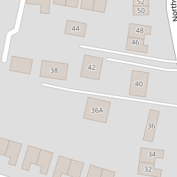


Leaflet © OpenStreetMap contributors
The heatmap indicates the level of crime in the area. The color of the heatmap indicates the crime severity and recency.
Metrics Year-on-Year
- Average area value
- 617,280.00 £Increased by 8.39 %
- Average area rental value
- 2,682.00 £/moIncreased by 50.76 %
- Est rental Yield
- 5.21 %Increased by 38.93 %
- Crime Rate
- 3.00 %Unchanged by 0.00 %
from 569,523.00 £
from 1,779.00 £/mo
from 3.75 %
from 3.00 %
Nearby Schools
| Name | Type | Ofsted | Distance |
|---|---|---|---|
| Dame Janet Primary Academy | Academy Sponsor Led | Good | 0.73 KM |
| St George'S Church Of England Foundation School | Foundation School | Good | 0.95 KM |
| Foreland Fields School | Foundation Special School | Good | 0.96 KM |
| The Royal Harbour Academy | Foundation School | Requires improvement | 1.09 KM |
| Small Haven School | Other Independent Special School | Good | 1.18 KM |
Images
Nearby Streets
| Name | Average Price | Average Sqft | Distance |
|---|---|---|---|
| Vincent Close | £ 400,000 | 0 | 0.00 KM |
| Holly Close | £ 0 | 0 | 0.00 KM |
| Windmill Avenue | £ 320,000 | 0 | 0.00 KM |
| Highfield Road | £ 252,500 | 0 | 0.00 KM |
| Pysons Road | £ 320,929 | 0 | 0.00 KM |
Nearby Transport
| Name | NLC | TLC | Distance |
|---|---|---|---|
| Ramsgate | 5023 | RAM | 1.63 KM |
| Dumpton Park | 5034 | DMP | 2.72 KM |
| Broadstairs | 5006 | BSR | 3.43 KM |
| Margate | 5018 | MAR | 4.82 KM |
| Westgate-On-Sea | 5195 | WGA | 7.74 KM |
Nearby Listings
| Address | Price | Type | Score | Distance |
|---|---|---|---|---|
| Northwood Road, Ramsgate, Kent | £ 375,000 | BUY | 7 / 10 | 0.06 KM |
| Northwood Road, Broadstairs, CT10 | £ 325,000 | BUY | 7 / 10 | 0.09 KM |
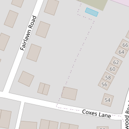
| Fairlawn Road, Ramsgate, CT12 6RZ | £ 325,000 | BUY | 7 / 10 | 0.13 KM |
| Coxes Lane, Ramsgate, CT12 | £ 810,000 | BUY | 9 / 10 | 0.14 KM |
| Coxes Lane, Ramsgate, CT12 6SA | £ 260,000 | BUY | Unknown | 0.16 KM |
Nearby Properties
| Address | Price | Distance |
|---|---|---|
| 36 Northwood Road | £ 275,000 | 0.00 KM |
| 32 Northwood Road | £ 297,500 | 0.00 KM |
| 42 Northwood Road | £ 295,000 | 0.00 KM |
| 38a Northwood Road | £ 59,950 | 0.00 KM |
| 24 Northwood Road | £ 177,000 | 0.10 KM |