UN
1 Dents Close
£ 355,000
Description
We don't have a Description for this property.
- Bedrooms
- 3
- Bathrooms
- 0
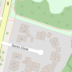
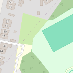

Leaflet © OpenStreetMap contributors
The heatmap indicates the level of crime in the area. The color of the heatmap indicates the crime severity and recency.
Metrics Year-on-Year
- Average area value
- 496,250.00 £Increased by 10.67 %
- Average area rental value
- 2,033.00 £/moIncreased by 6.22 %
- Est rental Yield
- 4.92 %Decreased by 3.91 %
- Crime Rate
- 1.00 %Unchanged by 0.00 %
from 448,423.00 £
from 1,914.00 £/mo
from 5.12 %
from 1.00 %
Nearby Schools
| Name | Type | Ofsted | Distance |
|---|---|---|---|
| New Marston Primary School | Academy Sponsor Led | Good | 0.29 KM |
| St Joseph'S Catholic Primary School, Oxford | Voluntary Aided School | Good | 0.72 KM |
| St Nicholas' Primary And Nursery School | Community School | Good | 1.02 KM |
| Oxfordshire Hospital School | Community Special School | Outstanding | 1.06 KM |
| The Swan School | Free Schools | 1.20 KM |
Images
Nearby Streets
| Name | Average Price | Average Sqft | Distance |
|---|---|---|---|
| Crotch Crescent | £ 400,000 | 0 | 0.00 KM |
| Butts Lane | £ 117,000 | 0 | 0.00 KM |
| Hill Farm Cottage | £ 0 | 0 | 0.00 KM |
| Buttercup Way | £ 0 | 0 | 0.00 KM |
| Brookside | £ 0 | 0 | 0.00 KM |
Nearby Transport
| Name | NLC | TLC | Distance |
|---|---|---|---|
| Oxford | 3115 | OXF | 4.87 KM |
| Oxford Parkway | 3121 | OXP | 6.22 KM |
| Islip | 3110 | ISP | 6.22 KM |
| Radley | 3118 | RAD | 9.46 KM |
Nearby Listings
| Address | Price | Type | Score | Distance |
|---|---|---|---|---|
| Oxford Oxfordshire | £ 525,000 | BUY | Unknown | 0.10 KM |
| Headington / Marston Borders, Oxfordshire, OX3 | £ 230,000 | BUY | Unknown | 0.17 KM |
| Brookfield Crescent, Headington, Oxford | £ 500,000 | BUY | Unknown | 0.22 KM |
| Horseman Close, Headington, OX3 | £ 375,000 | BUY | 5 / 10 | 0.24 KM |
| Copse Lane, Marston, Oxford | £ 350,000 | BUY | Unknown | 0.25 KM |
Nearby Properties
| Address | Price | Distance |
|---|---|---|
| 1 Dents Close | £ 355,000 | 0.00 KM |
| 3 Dents Close | £ 535,000 | 0.00 KM |
| 62 Marsh Lane | £ 250,000 | 0.08 KM |
| 52 Marsh Lane | £ 79,500 | 0.08 KM |
| 50 Marsh Lane | £ 446,000 | 0.08 KM |