UN
9 Howard Ridge
£ 400,000
Description
We don't have a Description for this property.
- Bedrooms
- 3
- Bathrooms
- 0
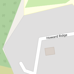
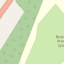

Leaflet © OpenStreetMap contributors
The heatmap indicates the level of crime in the area. The color of the heatmap indicates the crime severity and recency.
Metrics Year-on-Year
- Average area value
- 654,998.00 £Increased by 50.74 %
- Average area rental value
- 1,779.00 £/moIncreased by 26.53 %
- Est rental Yield
- 3.26 %Decreased by 15.98 %
- Crime Rate
- 2.00 %Unchanged by 0.00 %
from 434,508.00 £
from 1,406.00 £/mo
from 3.88 %
from 2.00 %
Nearby Schools
| Name | Type | Ofsted | Distance |
|---|---|---|---|
| Burpham Foundation Primary School | Foundation School | Outstanding | 0.20 KM |
| George Abbot School | Academy Converter | Good | 0.91 KM |
| Boxgrove Primary School | Academy Converter | Good | 1.83 KM |
| Boxgrove Sure Start Children'S Centre | Children's Centre | 1.83 KM | |
| Tormead School | Other Independent School | 2.10 KM |
Images
Nearby Streets
| Name | Average Price | Average Sqft | Distance |
|---|---|---|---|
| Meadow Road | £ 1,400,000 | 0 | 0.00 KM |
| Paddocks Road | £ 1,195,000 | 0 | 0.00 KM |
| The Cloisters | £ 0 | 0 | 0.00 KM |
| Belmont Place | £ 0 | 0 | 0.00 KM |
| Hawthorne Way | £ 855,000 | 0 | 0.00 KM |
Nearby Transport
| Name | NLC | TLC | Distance |
|---|---|---|---|
| London Road (Guildford) | 5632 | LRD | 2.75 KM |
| Guildford | 5631 | GLD | 4.21 KM |
| Worplesdon | 5686 | WPL | 4.64 KM |
| Clandon | 5555 | CLA | 5.38 KM |
| Shalford (Surrey) | 5638 | SFR | 5.50 KM |
Nearby Listings
| Address | Price | Type | Score | Distance |
|---|---|---|---|---|
| Burpham Lane, Burpham, Guildford, Surrey, GU4 | £ 550,000 | BUY | 7 / 10 | 0.16 KM |
| Manston Road, Burpham, GU4 | £ 700,000 | BUY | 6 / 10 | 0.20 KM |
| Parkside House, Burpham Lane, Guildford, Surrey, GU4 | £ 499,999 | BUY | 6 / 10 | 0.27 KM |
| Parkside House, Burpham Lane, Burpham, Guildford, GU4 | £ 499,999 | BUY | Unknown | 0.27 KM |
| Churchfields, Burpham, Guildford, Surrey, GU4 | £ 305,000 | BUY | Unknown | 0.32 KM |
Nearby Properties
| Address | Price | Distance |
|---|---|---|
| 6 Howard Ridge | £ 356,000 | 0.00 KM |
| 1 Howard Ridge | £ 677,500 | 0.00 KM |
| 15 Howard Ridge | £ 675,000 | 0.00 KM |
| 9 Howard Ridge | £ 400,000 | 0.00 KM |
| 8 Howard Ridge | £ 312,500 | 0.00 KM |