UN
14 Norlands Lane
£ 130,000
Description
We don't have a Description for this property.
- Bedrooms
- 4
- Bathrooms
- 0
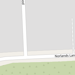


Leaflet © OpenStreetMap contributors
The heatmap indicates the level of crime in the area. The color of the heatmap indicates the crime severity and recency.
Metrics Year-on-Year
- Average area value
- 518,161.00 £Decreased by 11.11 %
- Average area rental value
- 1,618.00 £/moDecreased by 8.54 %
- Est rental Yield
- 3.75 %Increased by 3.02 %
- Crime Rate
- 2.00 %Unchanged by 0.00 %
from 582,913.00 £
from 1,769.00 £/mo
from 3.64 %
from 2.00 %
Nearby Schools
| Name | Type | Ofsted | Distance |
|---|---|---|---|
| T A S I S | Other Independent School | 1.50 KM | |
| Thorpe Lea Primary School | Community School | Good | 1.88 KM |
| The Magna Carta School | Academy Converter | Good | 1.99 KM |
| Our Lady Of The Rosary Rc Primary School | Voluntary Aided School | Good | 2.01 KM |
| Riverbridge Primary School | Academy Converter | Good | 2.13 KM |
Images
Nearby Streets
| Name | Average Price | Average Sqft | Distance |
|---|---|---|---|
| M3 | £ 2,950,000 | 0 | 0.00 KM |
| Thames Avenue | £ 0 | 0 | 0.00 KM |
| Bourne Avenue | £ 0 | 0 | 0.00 KM |
| The Crescent | £ 0 | 0 | 0.00 KM |
| St Peter's Close | £ 700,000 | 0 | 0.00 KM |
Nearby Transport
| Name | NLC | TLC | Distance |
|---|---|---|---|
| Staines | 5670 | SNS | 2.62 KM |
| Chertsey | 5553 | CHY | 2.78 KM |
| Egham | 5669 | EGH | 4.11 KM |
| Addlestone | 5550 | ASN | 5.40 KM |
| Virginia Water | 5676 | VIR | 5.43 KM |
Nearby Listings
| Address | Price | Type | Score | Distance |
|---|---|---|---|---|
| Redwood, Egham, Surrey, TW20 | £ 500,000 | BUY | 6 / 10 | 0.09 KM |
| Holland Gardens, Egham, Surrey, TW20 | £ 799,950 | BUY | 7 / 10 | 0.20 KM |
| Thorpeside Close, Staines, Surrey, TW18 | £ 685,000 | BUY | 7 / 10 | 0.27 KM |
| Staines-Upon-Thames, Runnymede, TW18 | £ 725,000 | BUY | 7 / 10 | 0.28 KM |
| Chertsey Lane, Staines, Surrey, TW18 | £ 950,000 | BUY | 7 / 10 | 0.53 KM |
Nearby Properties
| Address | Price | Distance |
|---|---|---|
| 6 Norlands Lane | £ 690,000 | 0.00 KM |
| Carmyle | £ 445,000 | 0.00 KM |
| 2 Norlands Lane | £ 327,500 | 0.00 KM |
| 10 Norlands Lane | £ 390,000 | 0.00 KM |
| 14 Norlands Lane | £ 130,000 | 0.00 KM |