UN
2 Bankside
£ 200,000
Description
We don't have a Description for this property.
- Bedrooms
- 1
- Bathrooms
- 0
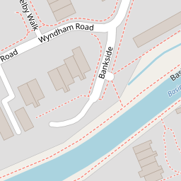


Leaflet © OpenStreetMap contributors
The heatmap indicates the level of crime in the area. The color of the heatmap indicates the crime severity and recency.
Metrics Year-on-Year
- Average area value
- 407,969.00 £Increased by 22.75 %
- Average area rental value
- 1,588.00 £/moDecreased by 6.20 %
- Est rental Yield
- 4.67 %Decreased by 23.57 %
- Crime Rate
- 7.00 %Unchanged by 0.00 %
from 332,352.00 £
from 1,693.00 £/mo
from 6.11 %
from 7.00 %
Nearby Schools
| Name | Type | Ofsted | Distance |
|---|---|---|---|
| Goldsworth Primary School | Academy Converter | 0.78 KM | |
| Sythwood Sure Start Children'S Centre | Children's Centre | 0.81 KM | |
| Sythwood Primary School | Academy Converter | Good | 0.83 KM |
| Horsell Cofe Aided Junior School | Voluntary Aided School | Good | 1.32 KM |
| North West Surrey Short Stay School | Pupil Referral Unit | Good | 1.35 KM |
Images
Nearby Streets
| Name | Average Price | Average Sqft | Distance |
|---|---|---|---|
| Eastmead Connector | £ 0 | 0 | 0.00 KM |
| Parley Drive | £ 0 | 0 | 0.00 KM |
| Julian Close | £ 0 | 0 | 0.00 KM |
| St John's Road | £ 535,000 | 0 | 0.00 KM |
| Langdale Close | £ 699,950 | 0 | 0.00 KM |
Nearby Transport
| Name | NLC | TLC | Distance |
|---|---|---|---|
| Woking | 5685 | WOK | 2.83 KM |
| Worplesdon | 5686 | WPL | 3.00 KM |
| Brookwood | 5687 | BKO | 6.05 KM |
| Longcross | 5674 | LNG | 7.82 KM |
| London Road (Guildford) | 5632 | LRD | 8.60 KM |
Nearby Listings
| Address | Price | Type | Score | Distance |
|---|---|---|---|---|
| Bankside, Woking, Surrey, GU21 | £ 260,000 | BUY | 6 / 10 | 0.04 KM |
| Waterside Way, Woking, GU21 | £ 380,000 | BUY | 6 / 10 | 0.07 KM |
| St Johns, Woking, GU21 | £ 425,000 | BUY | Unknown | 0.15 KM |
| Winnington Way, Woking, Surrey, GU21 | £ 650,000 | BUY | Unknown | 0.16 KM |
| Caradon Close, Woking, GU21 | £ 975,000 | BUY | 7 / 10 | 0.19 KM |
Nearby Properties
| Address | Price | Distance |
|---|---|---|
| 24 Bankside | £ 156,500 | 0.00 KM |
| 2 Bankside | £ 200,000 | 0.00 KM |
| 28 Bankside | £ 114,000 | 0.00 KM |
| 18 Bankside | £ 470,000 | 0.01 KM |
| 3 Bankside | £ 235,000 | 0.01 KM |