UN
5 Sandy Lane
£ 335,000
Description
We don't have a Description for this property.
- Bedrooms
- 3
- Bathrooms
- 0
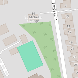

Leaflet © OpenStreetMap contributors
The heatmap indicates the level of crime in the area. The color of the heatmap indicates the crime severity and recency.
Metrics Year-on-Year
- Average area value
- 515,846.00 £Increased by 15.59 %
- Average area rental value
- 1,780.00 £/moIncreased by 8.01 %
- Est rental Yield
- 4.14 %Decreased by 6.55 %
- Crime Rate
- 0.00 %
from 446,283.00 £
from 1,648.00 £/mo
from 4.43 %
from 0.00 %
Nearby Schools
| Name | Type | Ofsted | Distance |
|---|---|---|---|
| Greenfield School | Other Independent School | 0.40 KM | |
| New Monument Primary Academy | Academy Converter | Good | 0.63 KM |
| St Dunstan'S Catholic Primary School, Woking | Voluntary Aided School | Outstanding | 1.15 KM |
| Hoe Bridge School | Other Independent School | 1.39 KM | |
| The Park School | Academy Special Sponsor Led | 1.43 KM |
Images
Nearby Streets
| Name | Average Price | Average Sqft | Distance |
|---|---|---|---|
| Oak Lane | £ 600,000 | 0 | 0.00 KM |
| Littlemoor Gardens | £ 0 | 0 | 0.00 KM |
| Kent Road | £ 0 | 0 | 0.00 KM |
| Monument Mews | £ 0 | 0 | 0.00 KM |
| Forest Close | £ 1,250,000 | 0 | 0.00 KM |
Nearby Transport
| Name | NLC | TLC | Distance |
|---|---|---|---|
| Woking | 5685 | WOK | 2.21 KM |
| West Byfleet | 5684 | WBY | 4.06 KM |
| Worplesdon | 5686 | WPL | 6.14 KM |
| Byfleet And New Haw | 5689 | BFN | 6.96 KM |
| Clandon | 5555 | CLA | 7.36 KM |
Nearby Listings
| Address | Price | Type | Score | Distance |
|---|---|---|---|---|
| Westerfolds Close, Woking, Surrey, GU22 | £ 500,000 | BUY | Unknown | 0.11 KM |
| Sandy Lane, Woking, Surrey, GU22 | £ 625,000 | BUY | 7 / 10 | 0.13 KM |
| Oldfield Wood, Woking, Surrey, GU22 | £ 1,200,000 | BUY | 6 / 10 | 0.14 KM |
| Mayhurst Avenue, Woking, Surrey, GU22 | £ 500,000 | BUY | 5 / 10 | 0.14 KM |
| Sandy Lane, Woking, Surrey, GU22 | £ 240,000 | BUY | Unknown | 0.15 KM |
Nearby Properties
| Address | Price | Distance |
|---|---|---|
| 5 Sandy Lane | £ 335,000 | 0.00 KM |
| 7 Sandy Lane | £ 340,000 | 0.00 KM |
| 17 Sandy Lane | £ 250,000 | 0.00 KM |
| 23 Sandy Lane | £ 342,500 | 0.00 KM |
| 1 Sandy Lane | £ 242,500 | 0.00 KM |