UN
62 The Meadway
£ 305,000
Description
We don't have a Description for this property.
- Bedrooms
- 3
- Bathrooms
- 0

Leaflet © OpenStreetMap contributors
The heatmap indicates the level of crime in the area. The color of the heatmap indicates the crime severity and recency.
Metrics Year-on-Year
- Average area value
- 435,915.00 £Increased by 10.38 %
- Average area rental value
- 1,208.00 £/moIncreased by 1.17 %
- Est rental Yield
- 3.33 %Decreased by 8.26 %
- Crime Rate
- 6.00 %Unchanged by 0.00 %
from 394,905.00 £
from 1,194.00 £/mo
from 3.63 %
from 6.00 %
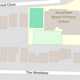
Nearby Schools
| Name | Type | Ofsted | Distance |
|---|---|---|---|
| Shoreham Beach Primary School | Community School | Good | 0.26 KM |
| Buckingham Park Primary School | Community School | Good | 1.10 KM |
| St Peter'S Catholic Primary School, Shoreham-By-Sea | Voluntary Aided School | Good | 1.19 KM |
| Kingston Buci Children & Family Centre | Children's Centre | 1.20 KM | |
| Swiss Gardens Primary School | Community School | Good | 1.37 KM |
Images
Nearby Streets
| Name | Average Price | Average Sqft | Distance |
|---|---|---|---|
| St Mary's Road | £ 349,975 | 0 | 0.00 KM |
| Western Road | £ 287,500 | 0 | 0.00 KM |
| John Street | £ 449,982 | 0 | 0.00 KM |
| High Street | £ 289,975 | 0 | 0.00 KM |
| Kings Walk | £ 1,050,000 | 0 | 0.00 KM |
Nearby Transport
| Name | NLC | TLC | Distance |
|---|---|---|---|
| Shoreham-By-Sea | 5277 | SSE | 0.70 KM |
| Southwick | 5286 | SWK | 3.67 KM |
| Fishersgate | 5284 | FSG | 5.51 KM |
| Lancing | 5275 | LAC | 5.99 KM |
| Portslade | 5276 | PLD | 7.08 KM |
Nearby Listings
| Address | Price | Type | Score | Distance |
|---|---|---|---|---|
| The Meadway, Shoreham-by-Sea | £ 500,000 | BUY | 6 / 10 | 0.00 KM |
| Cheal Close, Shoreham By Sea | £ 550,000 | BUY | 6 / 10 | 0.04 KM |
| Cheal Close, Shoreham, West Sussex, BN43 | £ 575,000 | BUY | 8 / 10 | 0.10 KM |
| Old Fort Road, Shoreham-By-Sea | £ 750,000 | BUY | 7 / 10 | 0.10 KM |
| Old Fort Road, Shoreham By Sea | £ 3,000,000 | BUY | 9 / 10 | 0.12 KM |
Nearby Properties
| Address | Price | Distance |
|---|---|---|
| 18 The Meadway | £ 640,000 | 0.00 KM |
| 52 The Meadway | £ 400,000 | 0.00 KM |
| 50 The Meadway | £ 465,000 | 0.00 KM |
| 4a The Meadway | £ 163,750 | 0.00 KM |
| 62 The Meadway | £ 305,000 | 0.00 KM |