UN
68 Sea Lane
£ 440,000
Description
We don't have a Description for this property.
- Bedrooms
- 5
- Bathrooms
- 0
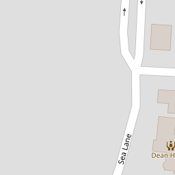

Leaflet © OpenStreetMap contributors
The heatmap indicates the level of crime in the area. The color of the heatmap indicates the crime severity and recency.
Metrics Year-on-Year
- Average area value
- 761,083.00 £Increased by 6.90 %
- Average area rental value
- 2,056.00 £/moDecreased by 3.34 %
- Est rental Yield
- 3.24 %Decreased by 9.75 %
- Crime Rate
- 6.00 %Unchanged by 0.00 %
from 711,963.00 £
from 2,127.00 £/mo
from 3.59 %
from 6.00 %
Nearby Schools
| Name | Type | Ofsted | Distance |
|---|---|---|---|
| East Preston Children And Family Centre | Children's Centre | 0.72 KM | |
| East Preston Junior School | Academy Converter | Good | 0.81 KM |
| East Preston Infant School | Community School | Good | 0.85 KM |
| Georgian Gardens Community Primary School | Community School | Requires improvement | 1.52 KM |
| The Angmering School | Community School | Requires improvement | 1.80 KM |
Images
Nearby Streets
| Name | Average Price | Average Sqft | Distance |
|---|---|---|---|
| Westfield Avenue | £ 0 | 0 | 0.00 KM |
| The Circle | £ 0 | 0 | 0.00 KM |
| Homelands Avenue | £ 975,000 | 0 | 0.00 KM |
| Norris Cottages | £ 0 | 0 | 0.00 KM |
| Mill Pond Way | £ 290,000 | 0 | 0.00 KM |
Nearby Transport
| Name | NLC | TLC | Distance |
|---|---|---|---|
| Angmering | 5267 | ANG | 1.41 KM |
| Goring-By-Sea | 5272 | GBS | 5.73 KM |
| Littlehampton | 5260 | LIT | 6.94 KM |
| Durrington-On-Sea | 5282 | DUR | 8.07 KM |
| Arundel | 5251 | ARU | 8.42 KM |
Nearby Listings
| Address | Price | Type | Score | Distance |
|---|---|---|---|---|
| Normandy Lane, East Preston, Littlehampton, BN16 | £ 550,000 | BUY | 7 / 10 | 0.09 KM |
| Sea Lane, East Preston, BN16 | £ 759,500 | BUY | 8 / 10 | 0.11 KM |
| Seaview Road, East Preston, BN16 | £ 955,000 | BUY | 7 / 10 | 0.16 KM |
| Seafield Road, East Preston, Littlehampton, West Sussex | £ 3,000,000 | BUY | Unknown | 0.17 KM |
| Seafield Road, Angmering, BN16 1NA | £ 3,000,000 | BUY | Unknown | 0.18 KM |
Nearby Properties
| Address | Price | Distance |
|---|---|---|
| 68 Sea Lane | £ 440,000 | 0.00 KM |
| 56 Sea Lane | £ 380,000 | 0.00 KM |
| 60 Sea Lane | £ 648,000 | 0.00 KM |
| 59a Sea Lane | £ 360,000 | 0.00 KM |
| 53 Sea Lane | £ 277,500 | 0.00 KM |