UN
29a Highfield Road
£ 135,000
Description
We don't have a Description for this property.
- Bedrooms
- 2
- Bathrooms
- 0
- Sqft
- 667.00
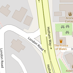


Leaflet © OpenStreetMap contributors
The heatmap indicates the level of crime in the area. The color of the heatmap indicates the crime severity and recency.
Metrics Year-on-Year
- Average area value
- 636,667.00 £Decreased by 17.62 %
- Est sale value
- 737,035.00 £Increased by 98.38 %
- Average area rental value
- 2,030.00 £/moIncreased by 3.89 %
- Est letting value
- 2,001.00 £/moIncreased by 200.00 %
- Est rental Yield
- 3.83 %Increased by 26.40 %
- Crime Rate
- 11.00 %Unchanged by 0.00 %
from 772,798.00 £
from 371,519.00 £
from 1,954.00 £/mo
from 667.00 £/mo
from 3.03 %
from 11.00 %
Nearby Schools
| Name | Type | Ofsted | Distance |
|---|---|---|---|
| Edward Bryant School | Academy Converter | Good | 0.42 KM |
| South Bersted Cofe Primary School | Voluntary Controlled School | Good | 0.61 KM |
| St Mary'S Catholic Primary School | Voluntary Aided School | Good | 0.66 KM |
| Bognor Regis Nursery School | Local Authority Nursery School | Outstanding | 1.11 KM |
| Bersted Green Primary School, Bognor Regis | Community School | Good | 1.11 KM |
Images
Nearby Streets
| Name | Average Price | Average Sqft | Distance |
|---|---|---|---|
| Gordon Avenue | £ 0 | 0 | 0.00 KM |
| Stanley Close | £ 90,000 | 0 | 0.00 KM |
| Melanie's Gardens | £ 0 | 0 | 0.00 KM |
| The Paddock | £ 289,950 | 0 | 0.00 KM |
| Highcroft Close | £ 0 | 0 | 0.00 KM |
Nearby Transport
| Name | NLC | TLC | Distance |
|---|---|---|---|
| Bognor Regis | 5253 | BOG | 0.74 KM |
| Barnham | 5252 | BAA | 5.64 KM |
Nearby Listings
| Address | Price | Type | Score | Distance |
|---|---|---|---|---|
| Highfield Road, Bognor Regis | £ 600,000 | BUY | 7 / 10 | 0.05 KM |
| Bankview Close, Bognor Regis, West Sussex, PO22 | £ 200,000 | BUY | 5 / 10 | 0.12 KM |
| Neville Road, Bognor Regis, PO22 | £ 335,000 | BUY | 6 / 10 | 0.13 KM |
| Upper Bognor Road, Bognor Regis | £ 185,000 | BUY | 5 / 10 | 0.13 KM |
| Neville Road, Bognor Regis, West Sussex | £ 250,000 | BUY | Unknown | 0.14 KM |
Nearby Properties
| Address | Price | Distance |
|---|---|---|
| 23a Highfield Road | £ 27,000 | 0.00 KM |
| 31 Highfield Road | £ 180,000 | 0.00 KM |
| 15b Highfield Road | £ 59,950 | 0.00 KM |
| 15a Highfield Road | £ 106,000 | 0.00 KM |
| 29a Highfield Road | £ 135,000 | 0.00 KM |