UN
4 Western Row
£ 180,675
Description
We don't have a Description for this property.
- Bedrooms
- 2
- Bathrooms
- 0
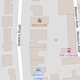


Leaflet © OpenStreetMap contributors
The heatmap indicates the level of crime in the area. The color of the heatmap indicates the crime severity and recency.
Metrics Year-on-Year
- Average area value
- 303,278.00 £Increased by 4.08 %
- Average area rental value
- 1,178.00 £/moDecreased by 4.31 %
- Est rental Yield
- 4.66 %Decreased by 8.09 %
- Crime Rate
- 32.00 %Unchanged by 0.00 %
from 291,380.00 £
from 1,231.00 £/mo
from 5.07 %
from 32.00 %
Nearby Schools
| Name | Type | Ofsted | Distance |
|---|---|---|---|
| Our Lady Of Sion School | Other Independent School | 0.49 KM | |
| Footprints Children And Family Centre | Children's Centre | 0.52 KM | |
| St Mary'S Catholic Primary School | Academy Sponsor Led | Good | 0.63 KM |
| Reflections Small School | Other Independent School | Good | 0.70 KM |
| Heene Cofe Primary School | Voluntary Aided School | Requires improvement | 0.73 KM |
Images
Nearby Streets
| Name | Average Price | Average Sqft | Distance |
|---|---|---|---|
| Tennyson Road | £ 0 | 0 | 0.00 KM |
| Norfolk Street | £ 0 | 0 | 0.00 KM |
| Montague Street | £ 501,667 | 0 | 0.00 KM |
| Richmond Road | £ 198,500 | 0 | 0.00 KM |
| Lansdowne Road | £ 360,000 | 0 | 0.00 KM |
Nearby Transport
| Name | NLC | TLC | Distance |
|---|---|---|---|
| Worthing | 5279 | WRH | 1.09 KM |
| West Worthing | 5278 | WWO | 1.84 KM |
| East Worthing | 5283 | EWR | 3.02 KM |
| Durrington-On-Sea | 5282 | DUR | 3.70 KM |
| Goring-By-Sea | 5272 | GBS | 6.04 KM |
Nearby Listings
| Address | Price | Type | Score | Distance |
|---|---|---|---|---|
| Western Row, Worthing | £ 415,000 | BUY | 7 / 10 | 0.01 KM |
| Western Row, Worthing | £ 375,000 | BUY | 6 / 10 | 0.02 KM |
| Western Place, Worthing, West Sussex, BN11 | £ 115,000 | BUY | 5 / 10 | 0.05 KM |
| Rowlands Road, Worthing | £ 240,000 | BUY | 6 / 10 | 0.06 KM |
| Western Place, Worthing, West Sussex, BN11 | £ 120,000 | BUY | Unknown | 0.07 KM |
Nearby Properties
| Address | Price | Distance |
|---|---|---|
| Spindrift Cottage | £ 273,000 | 0.00 KM |
| 6 Western Row | £ 299,950 | 0.00 KM |
| 4 Western Row | £ 180,675 | 0.00 KM |
| 3 Western Row | £ 325,000 | 0.00 KM |
| 8 Western Row | £ 360,000 | 0.00 KM |