UN
25 The Rowans
£ 310,000
Description
We don't have a Description for this property.
- Bedrooms
- 3
- Bathrooms
- 0
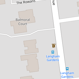

Leaflet © OpenStreetMap contributors
The heatmap indicates the level of crime in the area. The color of the heatmap indicates the crime severity and recency.
Metrics Year-on-Year
- Average area value
- 417,776.00 £Increased by 5.86 %
- Average area rental value
- 1,253.00 £/moDecreased by 3.76 %
- Est rental Yield
- 3.60 %Decreased by 9.09 %
- Crime Rate
- 3.00 %Unchanged by 0.00 %
from 394,636.00 £
from 1,302.00 £/mo
from 3.96 %
from 3.00 %
Nearby Schools
| Name | Type | Ofsted | Distance |
|---|---|---|---|
| Elm Grove Primary School, Worthing | Community School | Good | 0.91 KM |
| Tarring Children And Family Centre | Children's Centre Linked Site | 1.61 KM | |
| Heene Cofe Primary School | Voluntary Aided School | Requires improvement | 1.62 KM |
| Thomas A Becket Infant School | Community School | Good | 1.64 KM |
| St Mary'S Catholic Primary School | Academy Sponsor Led | Good | 1.69 KM |
Images
Nearby Streets
| Name | Average Price | Average Sqft | Distance |
|---|---|---|---|
| High Beeches | £ 515,000 | 0 | 0.00 KM |
| Rugby Road | £ 0 | 0 | 0.00 KM |
| Lansdowne Road | £ 360,000 | 0 | 0.00 KM |
| Rectory Road | £ 0 | 0 | 0.00 KM |
| Sea Place | £ 0 | 0 | 0.00 KM |
Nearby Transport
| Name | NLC | TLC | Distance |
|---|---|---|---|
| West Worthing | 5278 | WWO | 0.69 KM |
| Durrington-On-Sea | 5282 | DUR | 2.01 KM |
| Worthing | 5279 | WRH | 2.10 KM |
| Goring-By-Sea | 5272 | GBS | 4.36 KM |
| East Worthing | 5283 | EWR | 4.45 KM |
Nearby Listings
| Address | Price | Type | Score | Distance |
|---|---|---|---|---|
| The Rowans, Worthing, BN11 | £ 325,000 | BUY | Unknown | 0.04 KM |
| Grand Avenue, Worthing | £ 285,000 | BUY | 6 / 10 | 0.06 KM |
| Grand Avenue, West Worthing, West Sussex, BN11 5AH | £ 369,950 | BUY | 7 / 10 | 0.16 KM |
| Grand Avenue, Worthing | £ 350,000 | BUY | 7 / 10 | 0.17 KM |
| Pevensey Garden, Worthing, BN11 | £ 240,000 | BUY | 6 / 10 | 0.19 KM |
Nearby Properties
| Address | Price | Distance |
|---|---|---|
| 27 The Rowans | £ 124,999 | 0.00 KM |
| 26 The Rowans | £ 365,000 | 0.00 KM |
| 25 The Rowans | £ 310,000 | 0.00 KM |
| 1 The Rowans | £ 325,000 | 0.00 KM |
| 18 The Rowans | £ 275,000 | 0.00 KM |