UN
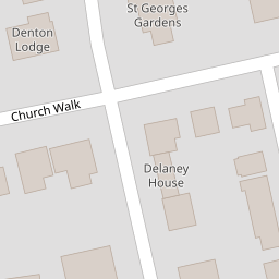
9 Church Walk
£ 542,000
Description
We don't have a Description for this property.
- Bedrooms
- 3
- Bathrooms
- 0

Leaflet © OpenStreetMap contributors
The heatmap indicates the level of crime in the area. The color of the heatmap indicates the crime severity and recency.
Metrics Year-on-Year
- Average area value
- 427,010.00 £Decreased by 6.10 %
- Average area rental value
- 1,279.00 £/moIncreased by 17.66 %
- Est rental Yield
- 3.59 %Increased by 25.09 %
- Crime Rate
- 7.00 %Unchanged by 0.00 %
from 454,765.00 £
from 1,087.00 £/mo
from 2.87 %
from 7.00 %
Nearby Schools
| Name | Type | Ofsted | Distance |
|---|---|---|---|
| Lyndhurst Children And Family Centre | Children's Centre Linked Site | 0.26 KM | |
| Lyndhurst Infant School | Community School | Good | 0.39 KM |
| Seadown School | Other Independent Special School | Inadequate | 0.41 KM |
| Davison Church Of England High School For Girls, Worthing | Voluntary Controlled School | Good | 0.56 KM |
| Chesswood Junior School | Community School | Good | 0.80 KM |
Images
Nearby Streets
| Name | Average Price | Average Sqft | Distance |
|---|---|---|---|
| Merton Terrace | £ 0 | 0 | 0.00 KM |
| Merton Road | £ 850,000 | 0 | 0.00 KM |
| Park Road | £ 342,083 | 0 | 0.00 KM |
| Kingsley Close | £ 0 | 0 | 0.00 KM |
| Meadow Road Flats | £ 180,000 | 0 | 0.00 KM |
Nearby Transport
| Name | NLC | TLC | Distance |
|---|---|---|---|
| East Worthing | 5283 | EWR | 0.83 KM |
| Worthing | 5279 | WRH | 2.08 KM |
| West Worthing | 5278 | WWO | 3.92 KM |
| Lancing | 5275 | LAC | 4.07 KM |
| Durrington-On-Sea | 5282 | DUR | 5.95 KM |
Nearby Listings
| Address | Price | Type | Score | Distance |
|---|---|---|---|---|
| Church Walk, Worthing | £ 240,000 | BUY | 6 / 10 | 0.03 KM |
| 19 Church Walk, Worthing, BN11 | £ 225,000 | BUY | 7 / 10 | 0.03 KM |
| Church Walk, Worthing | £ 390,000 | BUY | 6 / 10 | 0.04 KM |
| St. Georges Road, Worthing, BN11 2DS | £ 900,000 | BUY | 8 / 10 | 0.11 KM |
| St. Georges Road, Worthing | £ 240,000 | BUY | 5 / 10 | 0.14 KM |
Nearby Properties
| Address | Price | Distance |
|---|---|---|
| 7 Church Walk | £ 335,000 | 0.00 KM |
| 9 Church Walk | £ 542,000 | 0.00 KM |
| 15 Church Walk | £ 585,000 | 0.00 KM |
| 27 Church Walk | £ 291,000 | 0.00 KM |
| 11 Church Walk | £ 155,000 | 0.00 KM |