UN
45 Broadfields Road
£ 243,500
Description
We don't have a Description for this property.
- Bedrooms
- 4
- Bathrooms
- 0
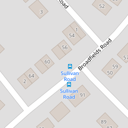
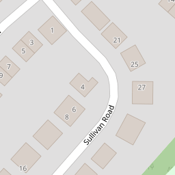

Leaflet © OpenStreetMap contributors
The heatmap indicates the level of crime in the area. The color of the heatmap indicates the crime severity and recency.
Metrics Year-on-Year
- Average area value
- 296,286.00 £Decreased by 13.22 %
- Average area rental value
- 1,262.00 £/moIncreased by 15.04 %
- Est rental Yield
- 5.11 %Increased by 32.38 %
- Crime Rate
- 1.00 %Unchanged by 0.00 %
from 341,435.00 £
from 1,097.00 £/mo
from 3.86 %
from 1.00 %
Nearby Schools
| Name | Type | Ofsted | Distance |
|---|---|---|---|
| St Peter'S Church Of England Aided School | Voluntary Aided School | Good | 0.37 KM |
| Woodwater Academy | Academy Sponsor Led | Good | 0.51 KM |
| St Nicholas Catholic Primary School | Academy Sponsor Led | Good | 0.54 KM |
| Clyst Heath Nursery And Community Primary School | Community School | Good | 1.14 KM |
| Whipton Barton Junior School | Academy Converter | 1.34 KM |
Images
Nearby Streets
| Name | Average Price | Average Sqft | Distance |
|---|---|---|---|
| Stanford Road | £ 350,000 | 0 | 0.00 KM |
| Warwick Road | £ 0 | 0 | 0.00 KM |
| Hardy Road | £ 500,000 | 0 | 0.00 KM |
| Drake Avenue | £ 139,975 | 0 | 0.00 KM |
| Montgomery Road | £ 0 | 0 | 0.00 KM |
Nearby Transport
| Name | NLC | TLC | Distance |
|---|---|---|---|
| Digby And Sowton | 5753 | DIG | 1.56 KM |
| Polsloe Bridge | 3422 | POL | 2.13 KM |
| Newcourt | 9589 | NCO | 2.24 KM |
| Pinhoe | 5757 | PIN | 2.74 KM |
| St James Park (Exeter) | 5751 | SJP | 4.13 KM |
Nearby Listings
| Address | Price | Type | Score | Distance |
|---|---|---|---|---|
| Broadfields Road, Exeter | £ 350,000 | BUY | 7 / 10 | 0.01 KM |
| Broadfields Road, Exeter, Devon | £ 360,000 | BUY | 6 / 10 | 0.01 KM |
| Broadfields Road, Exeter | £ 295,000 | BUY | 5 / 10 | 0.01 KM |
| Walton Road, Broadfields, Exeter, EX2 | £ 340,000 | BUY | 6 / 10 | 0.07 KM |
| Sullivan Road, Broadfields, Exeter | £ 490,000 | BUY | 7 / 10 | 0.13 KM |
Nearby Properties
| Address | Price | Distance |
|---|---|---|
| 36 Broadfields Road | £ 184,000 | 0.00 KM |
| 52 Broadfields Road | £ 269,950 | 0.00 KM |
| 45 Broadfields Road | £ 243,500 | 0.00 KM |
| 44 Broadfields Road | £ 170,000 | 0.00 KM |
| 46 Broadfields Road | £ 270,000 | 0.00 KM |