UN
57 Dunraven Drive
£ 191,500
Description
We don't have a Description for this property.
- Bedrooms
- 3
- Bathrooms
- 0

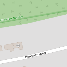

Leaflet © OpenStreetMap contributors
The heatmap indicates the level of crime in the area. The color of the heatmap indicates the crime severity and recency.
Metrics Year-on-Year
- Average area value
- 347,965.00 £Increased by 8.23 %
- Average area rental value
- 1,054.00 £/moIncreased by 24.15 %
- Est rental Yield
- 3.63 %Increased by 14.51 %
- Crime Rate
- 1.00 %Unchanged by 0.00 %
from 321,500.00 £
from 849.00 £/mo
from 3.17 %
from 1.00 %
Nearby Schools
| Name | Type | Ofsted | Distance |
|---|---|---|---|
| Notre Dame Rc School | Academy Converter | Good | 0.55 KM |
| Oakwood Primary Academy | Academy Converter | Good | 0.56 KM |
| Beechwood Primary Academy | Academy Converter | Good | 1.01 KM |
| Southernway Children'S Centre | Children's Centre | 1.09 KM | |
| Widewell Primary Academy | Academy Converter | Good | 1.21 KM |
Images
Nearby Streets
| Name | Average Price | Average Sqft | Distance |
|---|---|---|---|
| Notre Dame Close | £ 0 | 0 | 0.00 KM |
| Hazel Close | £ 0 | 0 | 0.00 KM |
| Hartland Close | £ 0 | 0 | 0.00 KM |
| Charlton Road | £ 0 | 0 | 0.00 KM |
| Richmond Road | £ 325,000 | 0 | 0.00 KM |
Nearby Transport
| Name | NLC | TLC | Distance |
|---|---|---|---|
| Plymouth | 3580 | PLY | 5.67 KM |
| Bere Ferrers | 3550 | BFE | 7.01 KM |
| Keyham | 3571 | KEY | 7.30 KM |
| Devonport | 3579 | DPT | 7.32 KM |
| St Budeaux Ferry Road | 3590 | SBF | 7.45 KM |
Nearby Listings
| Address | Price | Type | Score | Distance |
|---|---|---|---|---|
| Dunraven Drive, Derriford, Plymouth | £ 425,000 | BUY | 6 / 10 | 0.05 KM |
| Dunraven Drive, Derriford, Plymouth | £ 400,000 | BUY | 7 / 10 | 0.05 KM |
| Dunraven Drive, Derriford, Plymouth, Devon, PL6 | £ 375,000 | BUY | 7 / 10 | 0.05 KM |
| Moorland View, Derriford, Plymouth | £ 500,000 | BUY | Unknown | 0.22 KM |
| Moorland View, Derriford, Plymouth | £ 450,000 | BUY | 6 / 10 | 0.23 KM |
Nearby Properties
| Address | Price | Distance |
|---|---|---|
| 57 Dunraven Drive | £ 191,500 | 0.00 KM |
| 95 Dunraven Drive | £ 390,000 | 0.00 KM |
| 121 Dunraven Drive | £ 250,000 | 0.00 KM |
| 78 Dunraven Drive | £ 77,000 | 0.00 KM |
| 120 Dunraven Drive | £ 249,950 | 0.00 KM |