UN
71 Ringmore Way
£ 83,000
Description
We don't have a Description for this property.
- Bedrooms
- 3
- Bathrooms
- 0
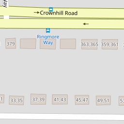

Leaflet © OpenStreetMap contributors
The heatmap indicates the level of crime in the area. The color of the heatmap indicates the crime severity and recency.
Metrics Year-on-Year
- Average area value
- 220,976.00 £Increased by 11.12 %
- Average area rental value
- 989.00 £/moIncreased by 15.54 %
- Est rental Yield
- 5.37 %Increased by 3.87 %
- Crime Rate
- 3.00 %Unchanged by 0.00 %
from 198,868.00 £
from 856.00 £/mo
from 5.17 %
from 3.00 %
Nearby Schools
| Name | Type | Ofsted | Distance |
|---|---|---|---|
| Sure Start Four Woods Children'S Centre | Children's Centre | 0.09 KM | |
| Knowle Primary School | Academy Converter | Good | 0.31 KM |
| Mill Ford School | Community Special School | Good | 0.81 KM |
| Ernesettle Community School | Academy Converter | Outstanding | 0.88 KM |
| Shakespeare Primary School | Academy Converter | 1.07 KM |
Images
Nearby Streets
| Name | Average Price | Average Sqft | Distance |
|---|---|---|---|
| Marldon Close | £ 130,000 | 0 | 0.00 KM |
| Kinsale Road | £ 0 | 0 | 0.00 KM |
| Carbis Close | £ 131,250 | 0 | 0.00 KM |
| Horsham Lane | £ 0 | 0 | 0.00 KM |
| Clifford Close | £ 200,000 | 0 | 0.00 KM |
Nearby Transport
| Name | NLC | TLC | Distance |
|---|---|---|---|
| St Budeaux Ferry Road | 3590 | SBF | 2.75 KM |
| St Budeaux Victoria Road | 3592 | SBV | 2.77 KM |
| Keyham | 3571 | KEY | 3.06 KM |
| Dockyard (Devonport) | 3588 | DOC | 3.66 KM |
| Devonport | 3579 | DPT | 3.91 KM |
Nearby Listings
| Address | Price | Type | Score | Distance |
|---|---|---|---|---|
| Ringmore Way, Plymouth | £ 210,000 | BUY | 6 / 10 | 0.11 KM |
| Ashburnham Road, Plymouth, Devon, PL5 | £ 250,000 | BUY | 7 / 10 | 0.14 KM |
| Cheriton Close, Plymouth, Devon, PL5 | £ 75,000 | BUY | Unknown | 0.18 KM |
| Cheriton Close, Plymouth, PL5 3QT | £ 60,000 | BUY | 5 / 10 | 0.18 KM |
| Coombe Park Lane, Honicknowle, Plymouth | £ 180,000 | BUY | 7 / 10 | 0.20 KM |
Nearby Properties
| Address | Price | Distance |
|---|---|---|
| 62 Ringmore Way | £ 104,000 | 0.00 KM |
| 71 Ringmore Way | £ 83,000 | 0.00 KM |
| 85 Ringmore Way | £ 126,000 | 0.00 KM |
| 97 Ringmore Way | £ 105,000 | 0.00 KM |
| 76 Ringmore Way | £ 115,000 | 0.00 KM |