UN
62 Clittaford Road
£ 124,950
Description
We don't have a Description for this property.
- Bedrooms
- 3
- Bathrooms
- 0
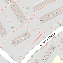
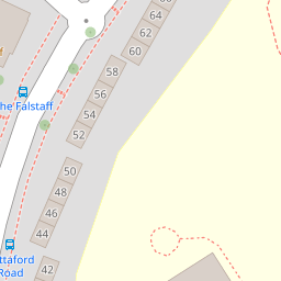

Leaflet © OpenStreetMap contributors
The heatmap indicates the level of crime in the area. The color of the heatmap indicates the crime severity and recency.
Metrics Year-on-Year
- Average area value
- 250,969.00 £Increased by 12.60 %
- Average area rental value
- 950.00 £/moIncreased by 2.26 %
- Est rental Yield
- 4.54 %Decreased by 9.20 %
- Crime Rate
- 18.00 %Unchanged by 0.00 %
from 222,882.00 £
from 929.00 £/mo
from 5.00 %
from 18.00 %
Nearby Schools
| Name | Type | Ofsted | Distance |
|---|---|---|---|
| Southernway Children'S Centre | Children's Centre | 0.23 KM | |
| Beechwood Primary Academy | Academy Converter | Good | 0.24 KM |
| Woodlands School | Foundation Special School | Good | 1.12 KM |
| Notre Dame Rc School | Academy Converter | Good | 1.15 KM |
| Oakwood Primary Academy | Academy Converter | Good | 1.39 KM |
Images
Nearby Streets
| Name | Average Price | Average Sqft | Distance |
|---|---|---|---|
| Magnus Close | £ 0 | 0 | 0.00 KM |
| Porsham Lane | £ 0 | 0 | 0.00 KM |
| Looseleigh Lane | £ 425,000 | 0 | 0.00 KM |
| Hartland Close | £ 0 | 0 | 0.00 KM |
| Silver Hill Close | £ 0 | 0 | 0.00 KM |
Nearby Transport
| Name | NLC | TLC | Distance |
|---|---|---|---|
| Bere Ferrers | 3550 | BFE | 5.79 KM |
| Plymouth | 3580 | PLY | 5.85 KM |
| St Budeaux Ferry Road | 3590 | SBF | 6.64 KM |
| St Budeaux Victoria Road | 3592 | SBV | 6.67 KM |
| Keyham | 3571 | KEY | 6.71 KM |
Nearby Listings
| Address | Price | Type | Score | Distance |
|---|---|---|---|---|
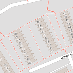
| Lundy Close, Southway, PL6 6HR | £ 180,000 | BUY | Unknown | 0.13 KM |
| Lundy Close, Plymouth, Devon, PL6 | £ 160,000 | BUY | 7 / 10 | 0.13 KM |
| Lundy Close, Southway, Plymouth, PL6 | £ 175,000 | BUY | 6 / 10 | 0.14 KM |
| Lundy Close, Plymouth, Devon, PL6 | £ 150,000 | BUY | 6 / 10 | 0.14 KM |
| Lundy Close, Southway | £ 150,000 | BUY | 5 / 10 | 0.14 KM |
Nearby Properties
| Address | Price | Distance |
|---|---|---|
| 62 Clittaford Road | £ 124,950 | 0.00 KM |
| 74 Clittaford Road | £ 118,000 | 0.00 KM |
| 85 Clittaford Road | £ 52,950 | 0.08 KM |
| 31 Lundy Close | £ 165,000 | 0.13 KM |
| 33 Lundy Close | £ 142,000 | 0.13 KM |