UN
98 Clittaford Road
£ 153,000
Description
We don't have a Description for this property.
- Bedrooms
- 2
- Bathrooms
- 0
- Sqft
- 818.00
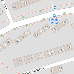

Leaflet © OpenStreetMap contributors
The heatmap indicates the level of crime in the area. The color of the heatmap indicates the crime severity and recency.
Metrics Year-on-Year
- Average area value
- 250,969.00 £Increased by 12.60 %
- Est sale value
- 212,680.00 £Increased by 14.04 %
- Average area rental value
- 950.00 £/moIncreased by 2.26 %
- Est letting value
- 0.00 £/mo
- Est rental Yield
- 4.54 %Decreased by 9.20 %
- Crime Rate
- 37.00 %Unchanged by 0.00 %
from 222,882.00 £
from 186,504.00 £
from 929.00 £/mo
from 0.00 £/mo
from 5.00 %
from 37.00 %
Nearby Schools
| Name | Type | Ofsted | Distance |
|---|---|---|---|
| Beechwood Primary Academy | Academy Converter | Good | 0.24 KM |
| Southernway Children'S Centre | Children's Centre | 0.29 KM | |
| Notre Dame Rc School | Academy Converter | Good | 1.09 KM |
| Oakwood Primary Academy | Academy Converter | Good | 1.21 KM |
| Woodlands School | Foundation Special School | Good | 1.27 KM |
Images
Nearby Streets
| Name | Average Price | Average Sqft | Distance |
|---|---|---|---|
| Magnus Close | £ 0 | 0 | 0.00 KM |
| Hartland Close | £ 0 | 0 | 0.00 KM |
| Porsham Lane | £ 0 | 0 | 0.00 KM |
| Looseleigh Lane | £ 425,000 | 0 | 0.00 KM |
| Notre Dame Close | £ 0 | 0 | 0.00 KM |
Nearby Transport
| Name | NLC | TLC | Distance |
|---|---|---|---|
| Bere Ferrers | 3550 | BFE | 5.93 KM |
| Plymouth | 3580 | PLY | 5.93 KM |
| St Budeaux Ferry Road | 3590 | SBF | 6.83 KM |
| St Budeaux Victoria Road | 3592 | SBV | 6.86 KM |
| Keyham | 3571 | KEY | 6.89 KM |
Nearby Listings
| Address | Price | Type | Score | Distance |
|---|---|---|---|---|
| Pentland Close, Plymouth, PL6 | £ 170,000 | BUY | 5 / 10 | 0.09 KM |
| Lundy Close, Southway, PL6 6JA | £ 170,000 | BUY | 5 / 10 | 0.11 KM |
| Skerries Road, Plymouth, PL6 6ED | £ 95,000 | BUY | 5 / 10 | 0.21 KM |
| Clittaford Road, Plymouth | £ 150,000 | BUY | 3 / 10 | 0.22 KM |
| Lundy Close, Plymouth, Devon, PL6 | £ 160,000 | BUY | 7 / 10 | 0.23 KM |
Nearby Properties
| Address | Price | Distance |
|---|---|---|
| 98 Clittaford Road | £ 153,000 | 0.00 KM |
| 94 Clittaford Road | £ 175,000 | 0.00 KM |
| 96 Clittaford Road | £ 112,000 | 0.00 KM |
| 102 Clittaford Road | £ 138,000 | 0.00 KM |
| 56 Lundy Close | £ 130,000 | 0.11 KM |