UN
Stymie
£ 525,000
Description
We don't have a Description for this property.
- Bedrooms
- 3
- Bathrooms
- 0
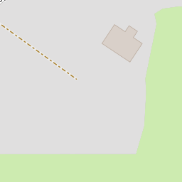


Leaflet © OpenStreetMap contributors
The heatmap indicates the level of crime in the area. The color of the heatmap indicates the crime severity and recency.
Metrics Year-on-Year
- Average area value
- 364,662.00 £Decreased by 25.59 %
- Average area rental value
- 919.00 £/moIncreased by 11.39 %
- Est rental Yield
- 3.02 %Increased by 49.50 %
- Crime Rate
- 1.00 %Unchanged by 0.00 %
from 490,095.00 £
from 825.00 £/mo
from 2.02 %
from 1.00 %
Nearby Schools
| Name | Type | Ofsted | Distance |
|---|---|---|---|
| St Margaret'S Church Of England (Aided) Junior School | Voluntary Aided School | Requires improvement | 0.72 KM |
| St George'S Church Of England (Va) Infant And Nursery School | Voluntary Aided School | Good | 0.87 KM |
| St Mary'S Church Of England Primary School | Voluntary Controlled School | Good | 1.59 KM |
| Bideford Bay Children'S Centre | Children's Centre | 1.66 KM | |
| Kingsley School | Other Independent School | 1.75 KM |
Images
Nearby Streets
| Name | Average Price | Average Sqft | Distance |
|---|---|---|---|
| Tudor Court | £ 0 | 0 | 0.00 KM |
| Churchill Way | £ 275,000 | 0 | 0.00 KM |
| Springfield Crescent | £ 334,975 | 0 | 0.00 KM |
| Century Drive | £ 0 | 0 | 0.00 KM |
| Radshall Park | £ 155,000 | 0 | 0.00 KM |
Nearby Listings
| Address | Price | Type | Score | Distance |
|---|---|---|---|---|
| Chope Road, Northam, Bideford | £ 699,950 | BUY | 6 / 10 | 0.07 KM |
| Bay View Court, Bay View Road, Northam, Bideford, EX39 | £ 500,000 | BUY | 7 / 10 | 0.11 KM |
| Northam, Bideford | £ 260,000 | BUY | 5 / 10 | 0.14 KM |
| Tudor Close, Northam | £ 550,000 | BUY | 6 / 10 | 0.21 KM |
| Heywood Road, Northam, Bideford | £ 325,000 | BUY | 7 / 10 | 0.24 KM |
Nearby Properties
| Address | Price | Distance |
|---|---|---|
| Sarum | £ 419,000 | 0.00 KM |
| The Drey | £ 380,000 | 0.00 KM |
| Stymie | £ 525,000 | 0.00 KM |
| Heathfield | £ 380,000 | 0.00 KM |
| Byways | £ 440,000 | 0.00 KM |